NASA National Snow and Ice Data Center Distributed Active Archive Center (NSIDC DAAC)

Enabling researchers and data users to better understand how changes in the cryosphere impact our planet.

Catch up on news and stories about how NSIDC DAAC data are being used in research, as well as spotlights on how you can use the data, tools and resources we offer. If you are using NSIDC DAAC data in your research, teaching, or some other way, let us know and we may feature your work in our next article. Share your story with us today.
News & Stories

Filter by:
nov11_fig1_1
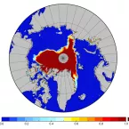
The rising interest in Arctic sea ice is the inverse of its decline: less ice equates to more demand for reliable data on sea ice conditions. But with decades of data from multiple satellite sensors and multiple research groups, where do researchers turn for the most reliable long-term view? In answer, NSIDC has produced a Climate Data Record for sea ice concentration, an important indicator of sea ice health and Arctic climate.
greenland_ice_velocity_3
NASA is making sure Earth data, called Earth system data records (ESDRs), remain valid. The NASA Making Earth System Data Records for Use in Research Environments (MEaSUREs) program supports scientists who make these long-term ESDRs in their area of speciality.
icebridge2_jakobshavn_thumb_3
Jakobshavn is not the only runaway glacier in Greenland—and together, faster moving glaciers are draining ice from the Greenland Ice Sheet into the ocean, adding to sea level rise.
deems_storm_tmb_3
NSIDC researchers are exploring an unexpected risk to the US Rocky Mountain snowpack and Western water supplies: a coating of desert dust. This desert dust landing on mountain snow may reduce water supplies for cities, agriculture, and industry far downstream.
moa_larsen_3
Antarctica's remote location and harsh conditions make it extremely difficult to map its thousands of miles of jagged coastline, its remote mountain ranges, and its vast ice sheet. NSIDC scientists helped solve that problem by combining more than 260 satellite images, mapping the surface and topography of the continent into a product called the Mosaic of Antarctica (MOA).
ice sheet elevation
The NASA Ice, Cloud, and land Elevation Satellite (ICESat) re-entered the Earth's atmosphere at approximately 5 a.m. EDT on August 30 over the Barents Sea. The mission reached the end of its productive seven-year life in June, when NASA began