Snow
Science
For snow to fall, moisture must be present in the atmosphere. Snowstorms also rely heavily on temperature, but not necessarily the temperature we feel on the ground. Snow forms when the atmospheric temperature is at or below freezing (0°C or 32°F). If the ground temperature is at or below freezing, the snow will reach the ground. However, the snow can still reach the ground when the ground temperature is above freezing if the conditions are just right. In this case, snowflakes will begin to melt as they reach this higher temperature layer; the melting creates evaporative cooling, which cools the air immediately around the snowflake. This cooling slows down melting. As a general rule, though, snow will not form if the ground temperature is at least 5°C (41°F).
While it can be too warm to snow, it cannot be too cold to snow. Snow can occur even at incredibly low temperatures, as long as there is some source of moisture and some way to lift or cool the air. It is true, however, that most heavy snowfalls occur when there is relatively warm air near the ground—typically -9°C (15°F) or warmer—since warmer air can hold more water vapor.
Because snow formation requires moisture, very cold but very dry areas may rarely receive snow. Antarctica's Dry Valleys, for instance, form the largest ice-free portion of the continent. The Dry Valleys are quite cold but have very low humidity, and strong winds help wick any remaining moisture from the air. As a result, this extremely cold region receives little snow.
How snow forms
Snow is an accumulation of packed ice crystals, and the condition of the snowpack determines a variety of qualities, such as color, temperature, and water equivalent. As weather conditions change, the snowpack can change as well, and this affects the characteristics of the snow.
Snow on the ground
The character of the snow surface after a snowfall depends on the original form of the crystals and on the weather conditions present when the snow fell. For example, when a snowfall is accompanied by strong winds, the snow crystals are broken into smaller fragments that can become more densely packed. After a snowfall, snow may melt or evaporate, or it may persist for long periods. If snow persists on the ground, the texture, size, and shape of individual grains will change even while the snow temperature remains below freezing, or they may melt and refreeze over time, and will eventually become compressed by subsequent snowfalls.
Over the winter season, the snowpack typically accumulates and develops a complex layered structure made up of a variety of snow grains, reflecting the weather and climate conditions prevailing at the time of deposition as well as changes within the snow cover over time.
The colors of snow
Generally, snow and ice present us with a uniformly white appearance. This is because visible light is white. Most all the visible light striking the snow or ice surface is reflected back without any particular preference for a single color. Most natural materials absorb some sunlight, which gives them their color. Clean snow, however, reflects most of the visible sunlight, creating a white appearance. How much sunlight the snowpack reflects to the atmosphere is characterized as snow's albedo.
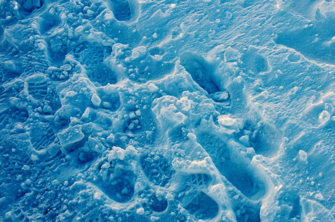
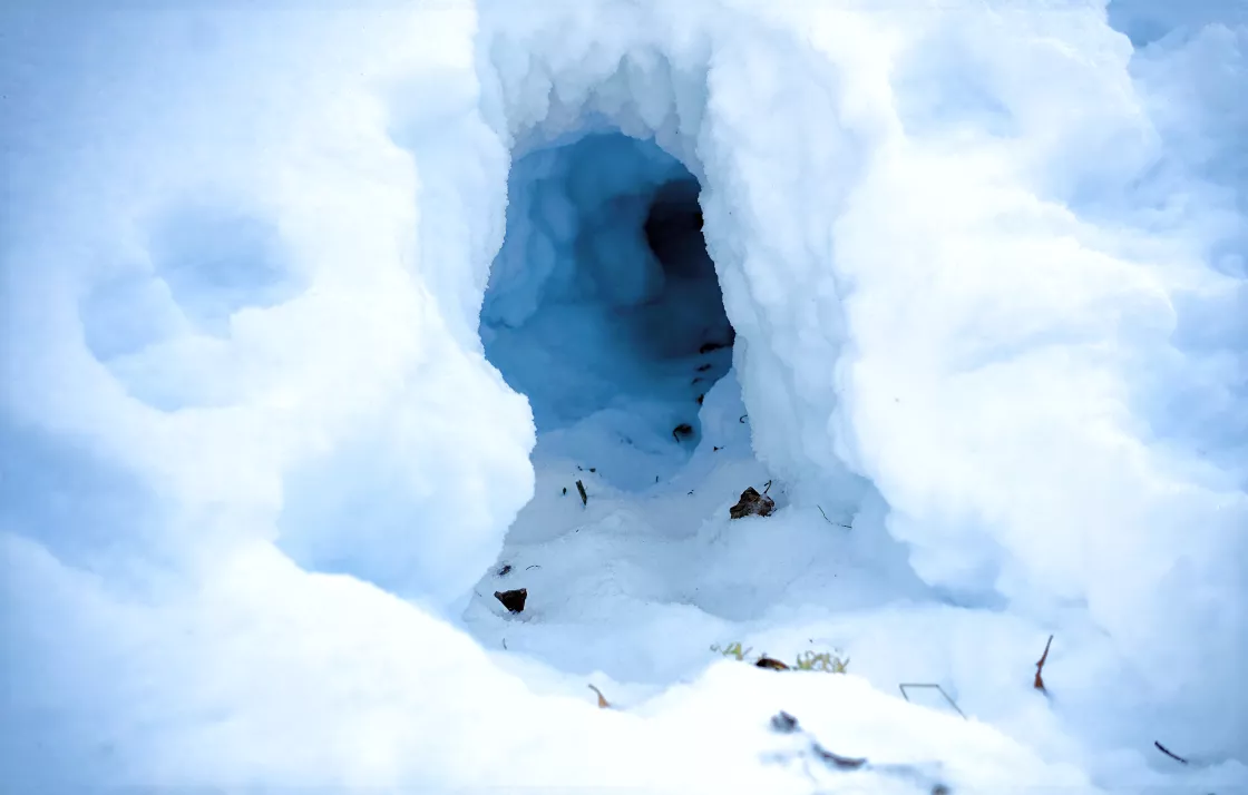
However, snow may also appear blue. As light waves travel into the snow or ice, the ice grains scatter a large amount of light. If light travels over any distance, it must survive many such scattering events. That is, it must keep scattering and not be absorbed. The observer sees the light coming back from the near surface layers after it has been scattered or bounced off other snow grains only a few times, and it still appears white. The absorption is preferential: More red light is absorbed than blue. The difference in absorption is small, but is enough that over a considerable distance, say a meter (3.3 feet) or more, photons emerging from the snow layer tend to be made up of more blue light than red light. For instance, if you were to poke a hole in the snow and look down into the hole, you may see a bluish color. In each case, the blue light is the product of a relatively long travel path through the snow or ice. Think of the ice or snow layer as a filter. If it is only a centimeter (0.39 inches) thick, all the light makes it through, but if it is about one meter (3.3 feet) thick, mostly blue light makes it through.
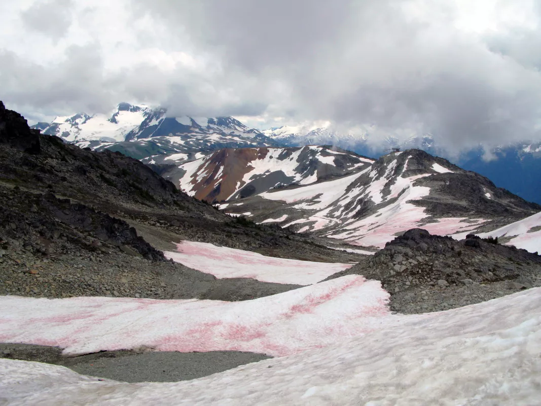
Particles or organisms within the snowpack may also affect the color of the snow. Watermelon snow, for instance, appears red or pink. This coloration is caused by a form of cryophilic, or cold-loving, fresh-water algae that contain a bright red pigment. Watermelon snow is most common during the summertime in high alpine areas as well as along coastal polar regions. Although this snow may look candy-colored, it is not wise to eat it. Blood Falls, in Antarctica's Taylor Glacier, also has red snow, but for a different reason. There, the deep red color is caused by saltwater leaking from an ancient reservoir under the glacier. This water is rich in a form of iron that oxidizes when it comes into contact with the atmosphere, producing a bright red waterfall.
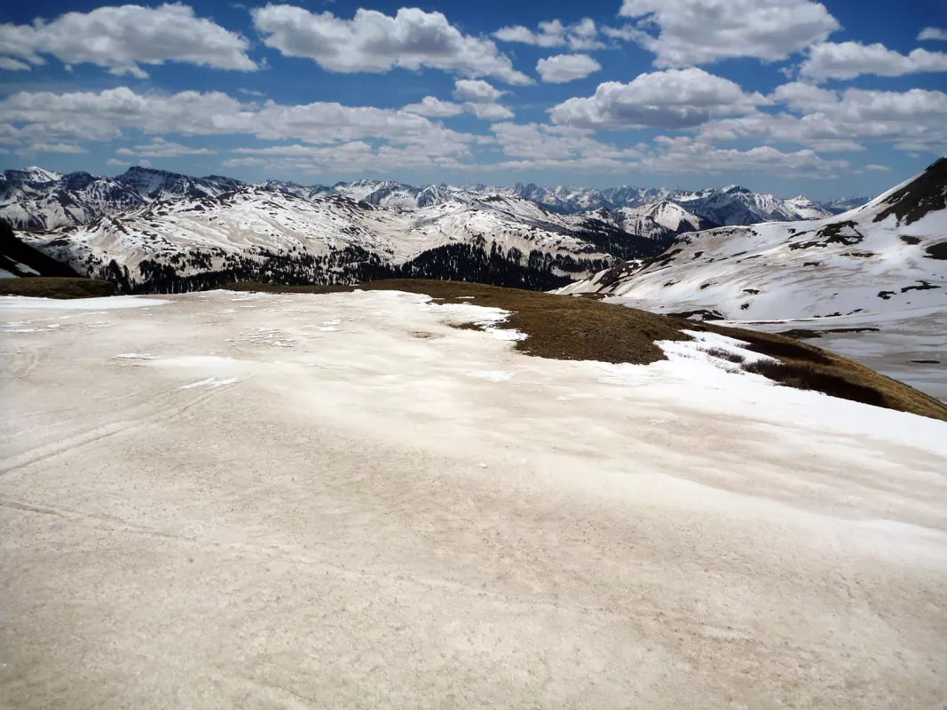
Dark-colored particles such as dust and soot can change snow's appearance and because they absorb more sunlight, hasten snow's retreat. Studies in the southwestern Colorado San Juan Mountains have shown that a layer of dust at the surface of a snowpack can shorten the duration of snow cover anywhere from 21 to 51 days. In contrast, an air temperature increase of 2 to 4°C (4 to 7°F) would shorten snow cover duration by only 5 to 18 days. Dust layers can become buried in the snowpack as new storms add clean snow on top, but these dust layers will emerge as the top layers melt away.
Snow and sound
The characteristics and age of snow can affect how sound waves travel, dampening them in some cases or enhancing them in others. For instance, people often notice how sound changes after a fresh snowfall. When the ground has a thick layer of fresh, fluffy snow, sound waves are readily absorbed into the snow surface, dampening sound. However, time and weather conditions may change the snow surface. If the surface melts and refreezes, the snow becomes smooth and hard. Then the surface will help reflect sound waves. Sounds may seem clearer and travel farther under these circumstances.
Snow may also crunch and creak. A layer of snow is made up of many tiny ice grains surrounded by air, and when you step on it, you compress the grains. As the snow compresses, the ice grains rub against each other. This creates friction or resistance; the lower the temperature, the greater the friction between the grains of ice. The sudden squashing of the snow at lower temperatures produces the familiar crunching sound. At higher temperatures, closer to melting, this friction is reduced to the point where the sliding of the grains against each other produces little or no noise. It is difficult to say at what temperature the snow starts to crunch, but the colder the snow, the louder the crunch.
Snow depth and temperature
The snow surface temperature is controlled by the air temperature above. The colder the air above, the colder the snow layers near the surface will be, especially within the top 30 to 45 centimeters (12 to 18 inches). Snow near the ground in deeper snowpack is warmer because it is close to the warm ground. The ground is relatively warm because the heat stored in the ground over the summer is slow to dissipate. In addition, snow is a good insulator, similar to the insulation in the ceiling of a house, and thus slows the flow of heat from the warm ground to the cold air above.
How much water is in snow?
Snow is composed of frozen water crystals, but because there is so much air surrounding each of those tiny crystals in the snowpack, most of the total volume of a snow layer is made up of air. We refer to the snow water equivalent of snow as the thickness of water that would result from melting a given layer of snow. An often-repeated assumption claims a ten-to-one ratio of snow to water, but that is not always accurate. The water equivalent of snow is more variable than most people realize. For instance, 25 centimeters (10 inches) of fresh snow can contain as little as 0.25 centimeters (0.10 inches) of water and as much as 10 centimeters (4 inches) of water, depending on crystal structure, wind speed, temperature, and other factors. The majority of new snowfall in the United States contains a water-to-snow ratio of between 0.04 (4 percent) and 0.10 (10 percent), depending on the meteorological conditions associated with the snowfall.
How big can snowflakes get?
Snowflakes are accumulations of many snow crystals. Most snowflakes are less than 1.3 centimeters (0.5 inches) across. Under certain conditions, usually requiring near-freezing temperatures, light winds, and unstable atmospheric conditions, much larger and irregular flakes can form, nearing 5 centimeters (2 inches) across. No routine measurements of snowflake dimensions are taken, so the exact size is not known.
Types of snow
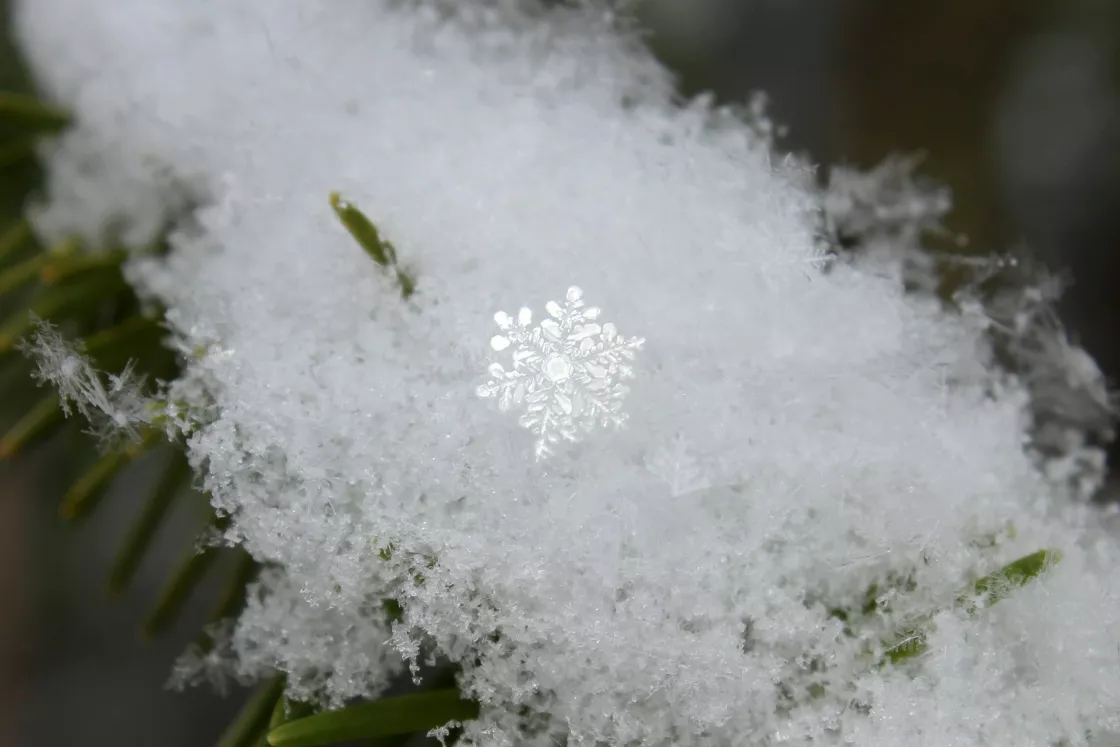
Atmospheric conditions affect how snow crystals form and what happens to them as they fall to the ground. Snow may fall as symmetrical, six-sided snowflakes, or it may fall as larger clumps of flakes. Similarly, once snow is on the ground, the snowpack may assume different qualities depending on local temperature changes, whether winds blow the snow around, or how long the snow has been on the ground. For instance, a fresh snowfall may be loose and powdery, but snow that has been on the ground throughout the winter may have dense, crusted layers caused by melting and refreezing. Scientists and meteorologists have classified types of snowfall, snowpack, and snow formations.
Types of snow crystals
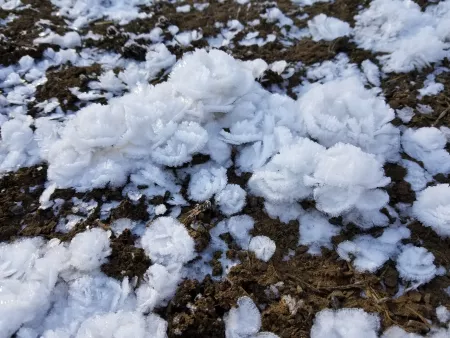
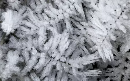
Hoar frost forms into flower blooms in a little valley in southwestern Idaho. These rose-petal crystals formed after weeks of night temperatures of -12°C (10°F) and only -7°C (20°F) during the day. — Credit: Ken Madlen An impressive amount of rime has built as a result of continuous deposition of air moisture onto grass after several long and cold nights that were too dry to produce precipitation. In December 2016, record drought in the European Alps brought rime frost in cold, shadowy locations instead of snow. — Credit: Daniela Domeisen/Imaggeo Snowflakes are single ice crystals or clusters of ice crystals that fall from a cloud.
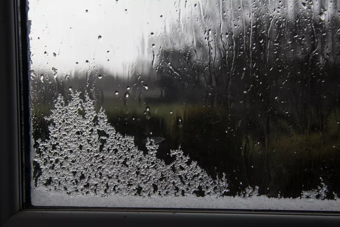
- Hoarfrost is the deposition of ice crystals on a surface when the temperature of the surface is lower than the frost point of the surrounding air. In this process, moisture goes directly from vapor to solid, skipping the liquid phase. Hoar frost is usually composed of interlocking ice crystals, and tends to form on objects of small diameter that are freely exposed to air, such as wires, poles, tree branches, plant stems, and leaf edges.
- Rime frost occurs when supercooled droplets freeze and attach onto an exposed surface. The moisture comes typically comes from freezing fog or mist droplets that turn directly from a liquid state to a solid state, with calm winds.
- Graupel consists of snowflakes that become rounded, opaque pellets ranging from 2 to 5 millimeters (0.1 to 0.2 inches) in diameter. They form as ice crystals fall through supercooled cloud droplets, which are below freezing but remain a liquid. The cloud droplets then freeze to the crystals, forming a lumpy mass. Graupel is sometimes mistaken for hail, but tends to have a texture that is softer and more crumbly. Graupel is sometimes also called snow pellets.
- Polycrystals are snowflakes composed of many individual ice crystals.
Types of snowfall
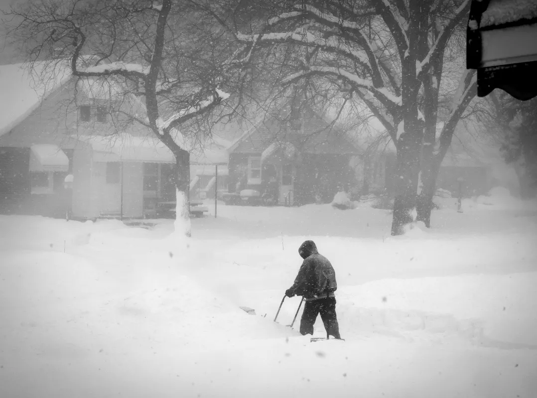
- A blizzard is a violent winter storm, lasting at least three hours, which combines subfreezing temperatures and strong winds laden with blowing snow that reduces visibility to less than 0.40 kilometers (0.25 miles).
- A snowstorm features large amounts of snowfall.
- A snow flurry is snow that falls for short durations and with varying intensity; flurries usually produce little accumulation.
- A snow squall is a brief, but intense snowfall that greatly reduces visibility and which is often accompanied by strong winds.
- A snowburst is a very intense shower of snow, often of short duration, that greatly restricts visibility and produces periods of rapid snow accumulation.
- Drifting snow is snow on the ground that is blown by the wind to a height of more than 2.5 meters (8 feet) above the surface. Once it rises above that height, it becomes blowing snow.
- Blowing snow describes airborne snow particles raised by the wind to moderate or great heights above the ground, at a height of 2.5 meters (8 feet) or more; the horizontal visibility at eye level is generally very poor.
Types of snow cover
Snow cover, also called a snowpack, is the total of all the snow and ice on the ground. It includes new snow and previous snow and ice that have not melted.
- New snow is a recent snow deposit in which the original form of the ice crystals can be recognized.
- Firn is rounded, well-bonded snow that is older than one year and has a density greater than 550 kilograms per cubic meter, or 55 percent.
- Névé is young, granular snow that has been partially melted, refrozen and compacted; névé that survives a full melt season is called firn. This type of snow is associated with glacier formation.
- Old snow indicates deposited snow whose transformation is so far advanced that the original form of the new snow crystals can no longer be recognized.
- Seasonal snow refers to snow that accumulates during one season or snow that lasts for only one season.
- Perennial snow is snow that persists on the ground year after year.
- Powder snow is dry new snow, which is composed of loose, fresh ice crystals.
Types of snow formations
Once on the ground, snow is subject to various weather conditions, including blowing wind, changing temperatures, and long periods of shade or sunshine. In certain instances, these elements can literally change the shape of the snow surface.
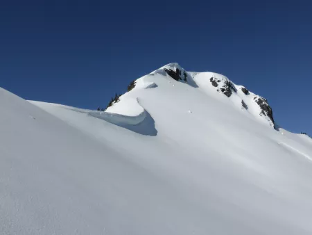
A cornice forms on the east arm of Ruth Mountain in Washington state. — Credit: Martin Bravenboer/Flickr A cornice is an overhanging accumulation of ice and wind-blown snow, characteristically found on the edge of a ridge or cliff face.
- A crust is a hard snow surface lying upon a softer layer, formed by sun, rain, or wind.
- Megadunes are giant dunes of snow in Antarctica composed of large snow crystals measuring up to 2 centimeters (3/4 inch) across.
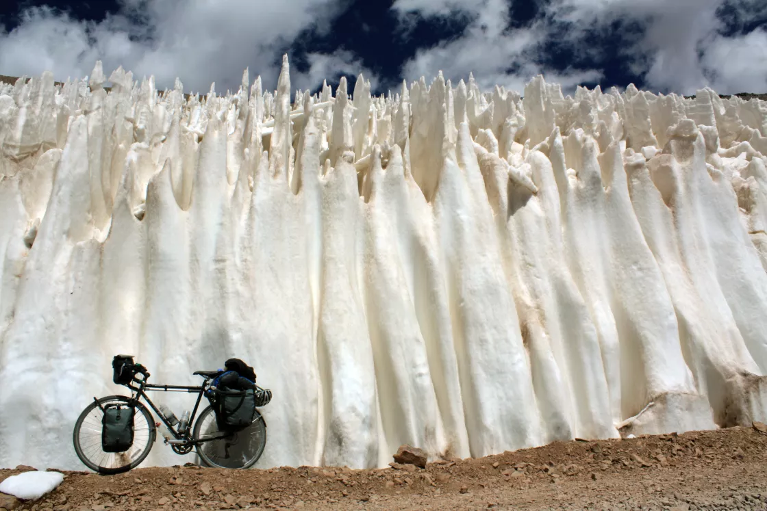
- Penitents are tall, thin, closely spaced pinnacles of hardened snow ranging in height from a few centimeters to a few meters. Fields of penitents can develop over glaciated and snow-covered areas, particularly in arid regions, such as the Dry Andes or in the mountains surrounding Death Valley in California.
- Ripple marks refer to the corrugation on a snow surface caused by wind, similar to the ripples sometimes seen in sand.
- Sastrugi occur when wind erodes or deposits snow in irregular grooves and ridges. Sastrugi sometimes result in delicate and fragile snow formations.
- A snow barchan is a horseshoe-shaped snowdrift, with the ends pointing downwind.
- A snow bridge is an arch formed by snow that has drifted across a crevasse, forming first a cornice, and ultimately a covering which may completely obscure the crevasse.
- A snow roller is a rare formation that occurs during specific meteorological conditions. Wind blows a chunk of snow along the ground, and the resulting snowball accumulates material as it rolls along. Snow rollers are cylindrical rather than circular. Some are shaped like donuts because the weak inner layers collapse and blow away.
- Sun cups refer to a pattern of shallow, bowl-shaped hollows that form during intense sunshine.
Snow and weather
Forecasting snow
Snow forecasts are better than they used to be, and they continue to improve, but snow forecasting remains a difficult challenge for meteorologists. One reason is that during intense snows, the heaviest snowfall can occur in surprisingly narrow bands, and on a smaller scale than observing networks and forecast zones can see. Also, the extremely small temperature differences that define the boundary line between rain and snow make large differences in snow forecasts. This is part of the fun and frustration that makes snow forecasting so interesting.
Because conditions in the atmosphere and on the ground can vary, each storm might produce a different type of snowfall. In addition, snow does not fall evenly everywhere. Even during the same storm, one neighborhood may receive deep snow, while an adjacent neighborhood may only receive a light dusting. At the local scale, variations in snow depth are caused primarily by wind during and after the storm, and by melting after the storm. At the larger scale, say across an entire state, it also depends on the storm track. Places in the middle of the storm track may receive significant snowfall, while locations along the edges of the storm may receive much less. Elevation changes also affect snowfall. As a snowstorm travels upslope toward a mountain summit, the storm typically drops more moisture. On the other side of the summit, snowfall is generally lighter.
Weather forecasters use a variety of terms to describe the intensity of snowfall:
- A snow flurry refers to light showers of snow that do not cover large areas and do not fall steadily for long periods of time.
- Freezing rain is precipitation that cools below 0°C (32°F) but does not turn to ice in the air. The water is supercooled. When the drops hit anything, they instantly turn into ice.
- An ice storm is a storm with large amounts of freezing rain that coats trees, power lines and roadways with ice.
- A blizzard is a severe winter storm that packs a combination of snow and wind, resulting in very low visibility. Officially, the National Weather Service defines a blizzard as large amounts of falling or blowing snow with winds in excess of 56 kilometers (35 miles) per hour and visibilities of less than 0.40 kilometers (0.25 miles) for more than 3 hours. While heavy snowfall and severe cold often accompany blizzards, they are not required. Sometimes, strong winds pick up snow that has already fallen, creating a ground blizzard.
Forecasters also rate the expected severity of blizzards and other snowy weather using a scale:
- A Winter Weather Advisory is issued for accumulations of snow, freezing rain, freezing drizzle, and sleet that may present a hazard but does not merit a warning.
- A Winter Storm Watch is issued to alert the public to the possibility of a blizzard, heavy snow, heavy freezing rain, or heavy sleet.
- A Winter Storm Warning is issued when a hazardous winter weather event is imminent or occurring and is considered a threat to life and property.
Blizzards
Blizzards can create a variety of dangerous conditions. Traveling by automobile can become difficult or even impossible because of whiteout conditions and drifting snow. The strong winds and low temperatures accompanying blizzards can combine to create other dangers. For instance, the wind chill factor is the amount of cooling one feels caused by a combination of wind and temperature. A strong wind combined with a temperature of just below freezing can have the same effect as a still air temperature -37°C (-35°F). A wind chill chart may be used to estimate the wind chill factor. Exposure to low wind chill values can result in frostbite or hypothermia. Frostbite is a severe reaction to cold exposure that can permanently damage its victim. Hypothermia is a condition brought on when the body temperature drops dangerously low, and can be fatal if not caught in time.
Blizzards also often cause related problems. Strong winds and heavy snow can cause tree limbs to fall onto structures or even utility lines, resulting in power outages. Drifts can block roads and sidewalks and make traveling difficult well after the storm is over.
Bomb cyclones
Although they have been discussed more often in recent years, bomb cyclones are not a new phenomenon; meteorologists have used the term for decades. Like all Northern Hemisphere cyclones, these storms move counterclockwise around their cores. Bringing snow and/or rain, bomb cyclones are characterized by low pressure, large scale, and rapid development. Under the right conditions, bomb cyclones may turn into blizzards.
Thundersnow
Although snowstorms typically occur in the winter, and thunderstorms typically occur during the summer, there are rare instances when meteorological conditions produce a phenomenon called thunder snow. In these instances, temperatures are low enough to generate snow instead of rain, and turbulence in the atmosphere causes the lighting and thunder.
Avalanches
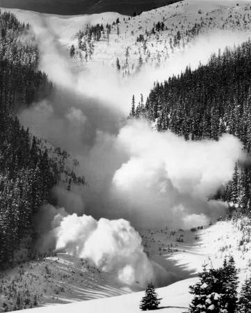
An avalanche is a mass of snow sliding down a slope. Although avalanches can occur on any slope given the right conditions, certain times of the year and certain locations are naturally more dangerous than others. Wintertime, particularly from December to April in the Northern Hemisphere, is when most avalanches tend to happen. However, avalanche fatalities have been recorded for every month of the year.
In the United States, avalanches kill on average 25 to 30 people each winter, injuring many more. Worldwide, avalanches kill more than 150 people annually. A very large avalanche in North America might release 100,000 cubic meters (131,000 cubic yards) of snow. That is the equivalent of 6 football fields filled 3 meters (10 feet) deep with snow.
Several factors may affect the likelihood of an avalanche, including weather, temperature, slope steepness, slope orientation (whether the slope is facing north or south), wind direction, terrain, vegetation, and general snowpack conditions. Different combinations of these factors can create low, moderate, or extreme avalanche conditions. The highest risk is typically during or right after a snowstorm. Underlying snowpack, covered by a quick blanket of snow, can cause a weaker slab to fracture naturally. Earthquakes can also trigger large avalanches. However, humans trigger 90 percent of avalanche accidents. Skiers, snowmobilers, snowshoers, climbers, and other recreationalists put force or stress on the snow, which then collapses the weaker layer beneath.
An avalanche has three main parts:
- The starting zone is the most volatile area of a slope, where unstable snow can fracture from the surrounding snow cover and begin to slide. Slope matters when it comes to avalanches. For instance, avalanches are possible on any slope above 30 degrees, where most avalanches occur between 30- and 45-degree slope. Snow naturally and regularly slides off steeper surfaces. At lower angles there is more gravity holding the snow together. Starting zones are often higher up on slopes or near convex areas. However, given the right conditions, snow can fracture at any point on the slope.
- The avalanche track is the path or channel that an avalanche follows as it goes downhill. Large vertical swaths of trees missing from a slope or chute-like clearings are often signs that large avalanches run frequently there, creating their own tracks. There may also be a large pile up of snow and debris at the bottom of the slope, indicating that avalanches have run.
- The runout zone is where the snow and debris finally come to a stop. Similarly, this is also the location of the deposition zone, where the snow and debris pile the highest.
Different parts of the world have their own avalanche classifications. In the United States, a number is given to rate avalanche destructiveness, where volumes and impact pressures go up exponentially like earthquake magnitude scales. Avalanches range in size from one to five, or low to extreme, with one unlikely to cause damage or bury a person. Any avalanche above a two has the potential to kill someone. The volume grows from 100 cubic meters (131 cubic yards) to 100,000 cubic meters (131,000 cubic yards) in terms of size.
Some conditions, such as temperature and snowpack, can change on a daily or hourly basis. Some states provide educational resources and current avalanche conditions online. To explore an example, go to the Colorado Avalanche Information Center or avalanche.org.
Effects of the polar vortex
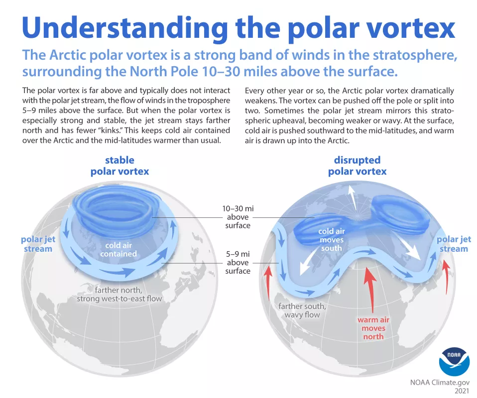
Both the Northern and Southern Hemispheres have atmospheric polar vortices—regions of cold air that rotate from west to east at latitudes farthest from the Equator. Because Earth's heavily populated land masses lie mostly in the Northern Hemisphere, that hemisphere's polar vortex has a larger weather effect on human activities.
The axis of rotation for the Northern Hemisphere polar vortex is roughly situated in the Arctic, and the Northern Hemisphere polar vortex contains both colder air and lower atmospheric pressure than regions to the south. Dividing the colder air of the polar vortex from the warmer air to the south is the polar jet stream, a fairly narrow band of winds that blow from west to east.
Although the Northern Hemisphere polar vortex can exhibit a fairly even circular shape, it is more often irregularly shaped, with troughs of cold air stretching southward, and ridges of warm air extending northward. The locations of these troughs and ridges change over time, as does the position of the jet stream. Storms generally form along the jet stream as cold troughs approach and depart a particular region. The approach of a cold polar trough is sometimes referred to as an Arctic outbreak.
Research & data
Research
Arctic Rain On Snow Study (AROSS) project
The Arctic Rain On Snow Study (AROSS) project, which began in 2020, is led by National Snow and Ice Data Center (NSIDC) director and Arctic scientist Mark Serreze. Rain on snow events occur when rain falls onto an existing snowpack and freezes, forming an ice crust that can have severe consequences for wildlife, infrastructure, and communities. AROSS seeks to better observe and understand rain on snow events by quantifying changes in these events, assessing their impacts on ecosystems and human societies, and determining how their frequency and intensity will change in coming decades. The project team will develop a database of all known rain on snow events across the Arctic since 1979, and incorporate data from surface observations, satellite, and output from modeling.
Snow Today
Snow Today, a joint NSIDC and Institute of Arctic and Alpine Research (INSTAAR) project, is a scientific analysis website that provides a snapshot and interpretation of snow conditions in near-real time across the Western United States. Snow Today uses a unique combination of satellite data and surface observations. The website updates daily images on snow conditions and relevant data as well as monthly scientific analyses, which are published monthly during each snow season. Snow Today tracks unusual events, such as California's record snowpack in spring 2023.
Snow Today examines where snow is present, where it has snowed recently, and how much water is in the snow, while also comparing between snow today, snow yesterday, snow last year, and snow over the last few decades.
Data
NSIDC archives and distributes a wide range of snow data to better understand the role of snow on Earth and how snow patterns are changing. You can learn more about the types of data collections that include snow-related data by filtering NSIDC's data collections by the geophysical measurement “snow.”
