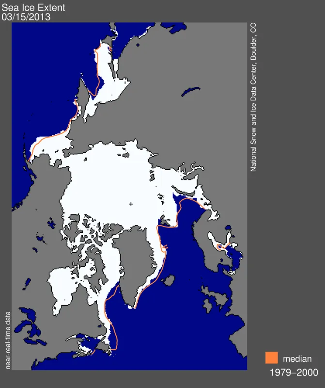
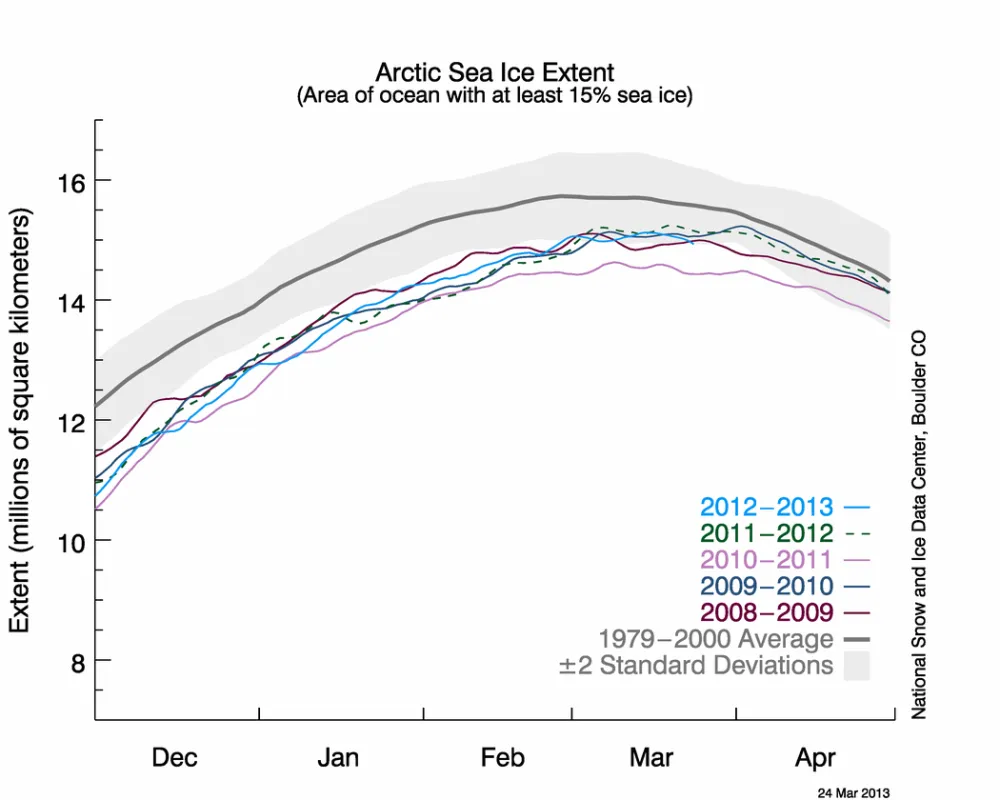
On March 15, 2013, Arctic sea ice extent appears to have reached its annual maximum extent, marking the beginning of the sea ice melt season. This year’s maximum extent was the sixth lowest in the satellite record. NSIDC will release a detailed analysis of the 2012 to 2013 winter sea ice conditions in early April.
Overview of conditions
On March 15, 2013 Arctic sea ice likely reached its maximum extent for the year, at 15.13 million square kilometers (5.84 million square miles). The maximum extent was 733,000 square kilometers (283,000 square miles) below the 1979 to 2000 average of 15.86 million square kilometers (6.12 million square miles). The maximum occurred five days later than the 1979 to 2000 average date of March 10. The date of the maximum has varied considerably over the years, with the earliest maximum in the satellite record occurring as early as February 24 in 1996 and as late as April 2 in 2010.
This year’s maximum ice extent was the sixth lowest in the satellite record. The lowest maximum extent occurred in 2011. The ten lowest maximums in the satellite record have occurred in the last ten years, 2004 to 2013.
Conditions in context
Over the 2012 to 2013 winter season, sea ice extent grew a record 11.72 million square kilometers (4.53 million square miles). The record growth was primarily a result of the record low minimum last September, leaving a greater extent of ocean surface uncovered in ice to re-freeze this winter. This seasonal ice gain is 645,000 square kilometers (249,000 square miles) higher than the previous record (2007 to 2008) and 2.63 million square kilometer (1.02 million square miles) higher than the 1979 to 2000 average. Last autumn’s record low and this winter’s record ice growth indicate a more pronounced seasonal cycle in Arctic sea ice and the increasing dominance of first-year ice in the Arctic.
Final analysis pending
At the beginning of April, NSIDC scientists will release a full analysis of winter conditions, along with monthly data for March.

