Glaciers
Why they matter
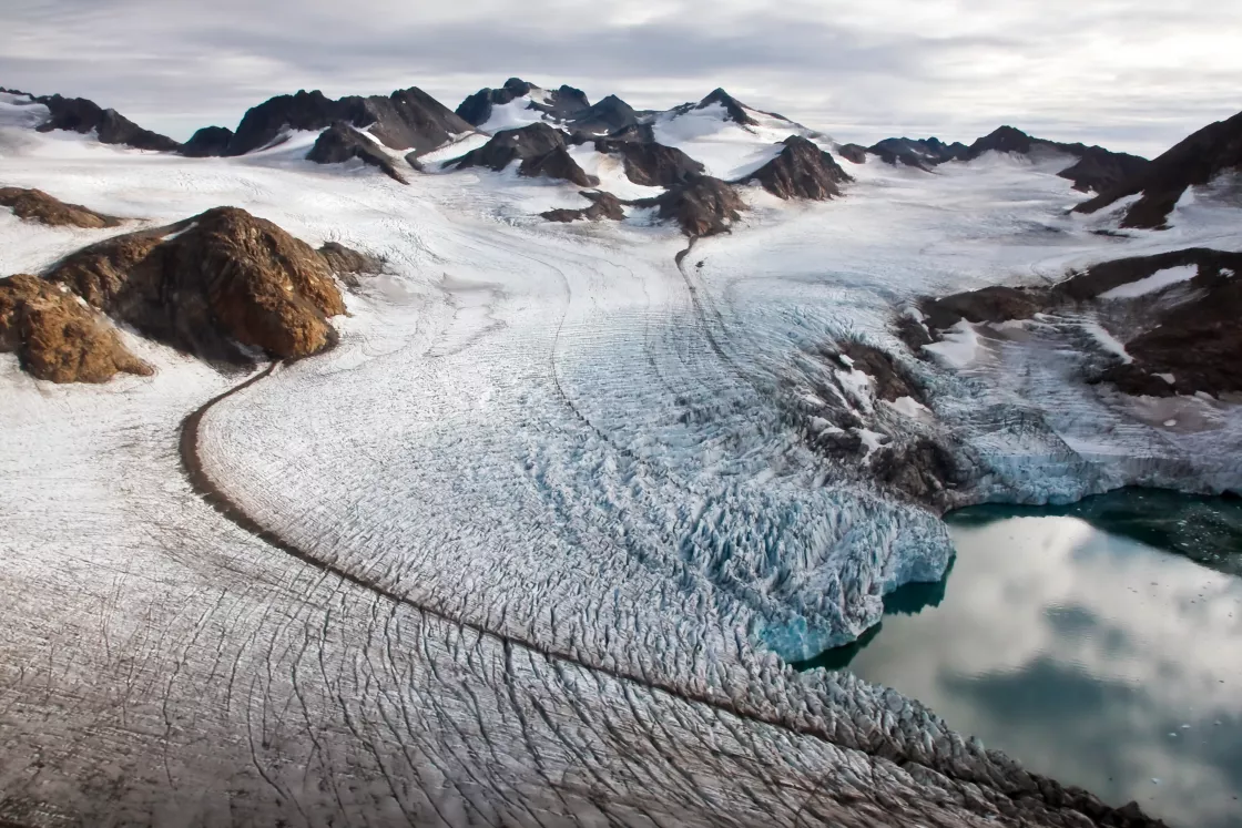
Glaciers, slow-moving rivers of ice, have sculpted mountains and carved valleys throughout Earth's history. They continue to flow and shape the landscape in many places today. But glaciers affect much more than the landscape.
Glacier melt delivers nutrients into lakes, rivers, and oceans. Those nutrients can drive blooms of phytoplankton—the base of aquatic and marine food chains. Meanwhile, gradual glacier melt sustains stream habitats for plants and animals. So, glaciers often have an indirect impact on wildlife and fisheries.
In some regions, glaciers provide life-sustaining water for people as well as wildlife. For instance, the Amu Darya, a major river in Central Asia, derives part of its water supply from glacier melt. Averaged over the year, that melt accounts for only 8 percent of annual river flow, but it accounts for 27 percent of river flow in late summer, when snow melt provides relatively little water.
Glaciers also impact sea level. The cryosphere consists of all the places on Earth where water is frozen, including snow, sea ice, ice sheets, and glaciers. Though glaciers and ice caps account for only 0.5 percent of total land ice, their contribution to sea level rise during the last century exceeded that of the ice sheets. Since then, however, ice sheets have caught up and are expected to play a more significant role in the future.
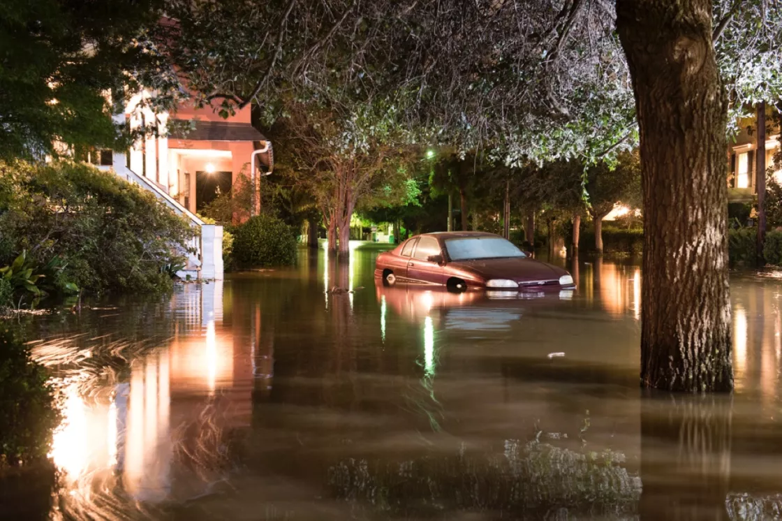
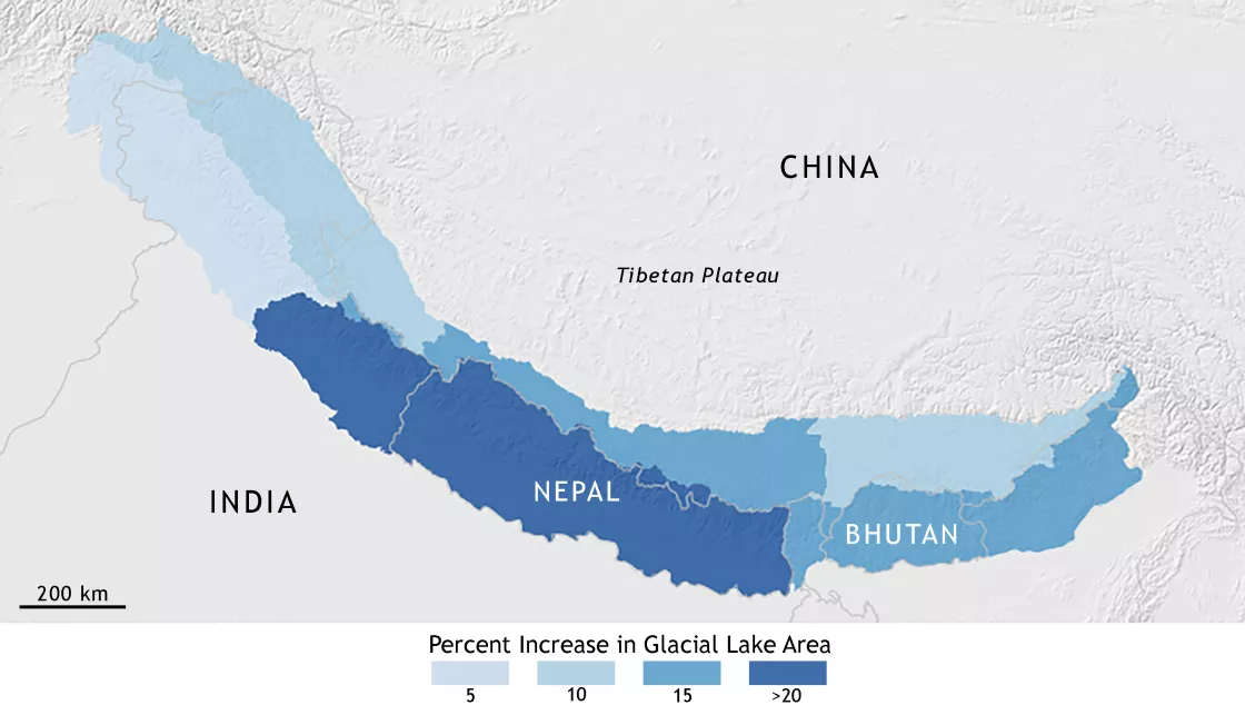
Glaciers also can pose hazards to people living downstream. Glacier-fed lakes can breach their moraine dams, causing catastrophic floods. Hazards seem to be increasing in some places, as glacial lakes expand as a result of glacier shrinkage.
Glaciers and people
Today, glaciers are often tourist attractions in mountainous areas. But glaciers are also a natural resource, and people all over the world use the meltwater that glaciers produce.
Glaciers provide drinking water
People living in arid climates near mountains often rely on glacial melt for their water for part of the year. Many of the rivers coursing through China, India, and other parts of the Asian continent are fed largely by snowmelt from the Himalaya, but in late summer, a significant part of river flow comes from melting glaciers. In South America, residents of La Paz, Bolivia, rely on glacial melting from a nearby ice cap to provide water during the significant dry spells they sometimes experience.
Demand for glacier water has increased in other, perhaps less expected ways, too. Some beverage companies sell bottles of glacial meltwater, and ice cubes made of glacier ice are popular in some specialty drinks. In fact, a Chilean man was arrested in 2012 for stealing five tons of ice from the Jorge Montt Glacier. He had planned to sell the ice to restaurants in the capital, Santiago.
Glaciers irrigate crops
In Switzerland's Rhone Valley, farmers have irrigated their crops for hundreds of years by channeling meltwater from glaciers to their fields.
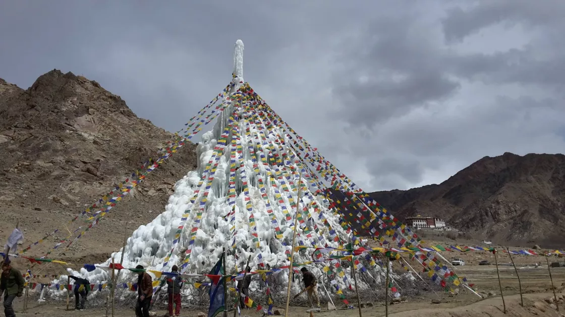
A local legend tells the story of villagers in Northern Pakistan growing glaciers to thwart Genghis Khan’s invasion. Beyond legends, the Hindu Kush, Himalaya, and Karakoram mountain ranges have a history of grafting glaciers to store water in the winter for slow release during the spring growing season. In Ladakh, India, the engineer Chewang Norphel earned the nickname of Ice Man after building over a dozen artificial "glaciers."
Ladakh is a high, cold desert that receives only 50 to 70 millimeters (2 to 2.8 inches) of rain a year. Most of Ladakh’s water comes from snow melt and glacial melt. About 80 percent of the population relies on farming. According to Norphel, water shortage has been a concern for local farmers since the 1980s.
Winters are severe in Ladakh, one of the highest regions in the world, located in northwestern India. Whatever water flows during the winter is lost. Natural glaciers are about 20 kilometers (12 miles) away from the village and because they are above 5,000 meters (16,000 ft), they begin to melt in June—past the sowing season when water is needed. So Norphel thought, what if there were glaciers at lower altitudes that could melt sooner to provide water during the early spring? He built his first, low-cost glacier in 1987.
The process involves several steps. In November and December, water gets diverted to the shady side of the mountain by an intricate network of water channels and mini dams along the upper slope of the valley. This slows down the water and lets it freeze, as fast-flowing water would not. To ensure efficiency of water distribution, the artificial glaciers are placed at various altitudes like steps. When spring arrives, the glacier at the lowest altitude melts first. As temperatures continue to rise into summer, the higher glaciers melt to provide water later in the season.
Ice stupas are the latest version of artificial glaciers. Designed by Sonam Wangchuk, a mechanical engineer from the Ladakh region, the ice stupa is a vertical cylinder of ice built in the middle of villages at lower elevations. The idea behind the shape is basic geometry in that there is little surface area exposed to the sun, so even when the sun is shining, the ice stupa remains frozen.
To form an ice stupa, a pipe collects meltwater and extends into the shade of the mountain. The water is sprayed up and freezes as it falls through cold air. The first prototype was built in the 2013-2014 winter. It took a month to build the ice stupa, which was about 7 meters (22 feet) high. For more information, visit the Ice Stupa Project or the New Yorker’s, The Ice Stupas: Artificial glaciers at the edge of the Himalayas.
Glaciers help generate hydroelectric power
Scientists and engineers in Norway, Central Europe, Canada, New Zealand, and South America have worked together to tap into glacial resources, generating electricity by damming glacial meltwater.
Are glaciers dangerous?
Glaciers are usually found in remote mountainous areas. However, some are found near cities or towns and sometimes present a problem for people living close by. Lakes formed on top of or in front of a glacier may cause floods. At the terminus, or snout, of a valley glacier, ice falling from the glacier presents a hazard to hikers below. When ice breaks off in a lake or the ocean, an iceberg is formed, which can cause dangerous waves. Some examples of these hazards are listed below.
Flooding caused by a glacier
In high mountain regions, glaciers can be the root cause of several natural catastrophes. Although it is not uncommon for a glacier to have a small lake of meltwater near its terminus, extreme or unusually fast melting, or ice or rock avalanches into these lakes, can cause water to overflow their barriers and cause flooding downstream. These are called glacial lake outburst floods.
Another dangerous case occurs when a glacier flows across a stream or river, creating a dam that can trap a large amount of water. In spring 1986, Hubbard Glacier in Alaska surged and blocked the outlet of Russell Fjord, entrapping a large lake. Over the summer, snowmelt continued to fill the lake. In October, the glacier-created dam gave way. The fjord reconnected to the ocean, only after releasing an enormous gush of water equivalent to about 35 Niagara Falls.
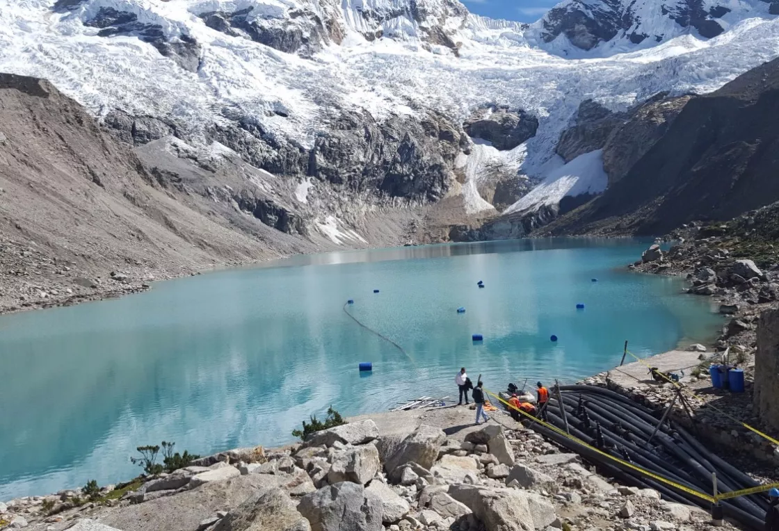
In 1941 in Peru, up to 5,000 people perished after an earthquake sent a chunk of glacial ice into Lake Palcacocha, causing a flood wave to crash into the town of Huaraz below. Since then, glacial melt has bloated the lake. Pumps have been put in place to reduce the lake's level, but this may not be enough to prevent a future flood wave. As of 2021, about 50,000 people live in the danger zone in Huaraz.
As mountain glaciers melt and recede, the glaciers' old terminal moraines often contain large glacial lakes like Lake Palcacocha. These glacial lakes are found throughout the world and can pose a significant flood hazard to downstream communities and infrastructure.
Avalanches from glaciers
Ice avalanches from glacier snouts have been recorded in the Swiss Alps for centuries, and they still occur despite attempts to prevent them. In 1965, the government of Switzerland was constructing a dam for a hydroelectric plant above the town of Mattmark. Without warning, an enormous mass of ice from the nearby Allalingletscher broke off. In mere seconds, the avalanche had rushed down the slopes and buried much of the construction camp, killing 88 workers.
In September 2002, the Kolka Glacier surged in the Russian Republic of North Ossetia. The glacial debris flow, where enormous chunks of ice mixed with water and stone, broke loose and blazed down the valley, stripping trees along the slopes and towering over 100 meters (330 feet). The glacial avalanche buried the village of Nizhnii Karmadon and killed over 100 people.
In August 2020, following several unusually warm days, officials in northwestern Italy evacuated part of an Alpine resort, fearing a huge portion of a Mont Blanc glacier could collapse and crash into the valley below. Glaciologists monitoring Planpincieux Glacier warned that about 500,000 cubic meters (17.7 million cubic feet) of ice, about the size of Milan’s cathedral, could slip off the glacier. Water flowing underneath could act like a slide. It would take less than two minutes for the mass to cover the road below. According to the European Geosciences Union, the Alps, where Mont Blanc is the highest mountain in Europe, could lose 50 percent of their glacier volume from 2017 to 2050.
The threat of icebergs
Icebergs that have broken off, or calved, from ice shelves and tidewater glaciers pose a significant threat to sea lanes worldwide. One of the most famous examples is the Titanic, which in April 1912 carried 1,503 passengers (68 percent of those onboard) to a watery grave after colliding with an iceberg that ripped a large hole in the ship. Shipping lanes along the coasts of Greenland and Newfoundland are historically iceberg-infested waters.
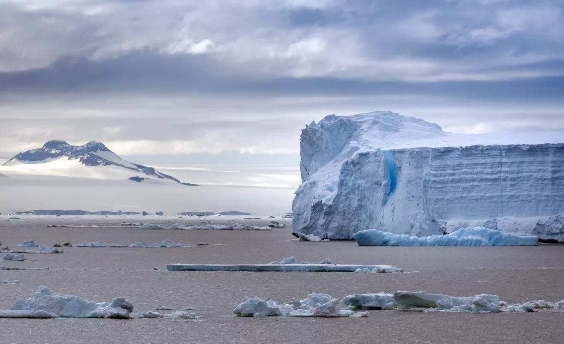
Icebergs calved by glacial ice continue to present problems even today. In 1995, an enormous iceberg, over 80 kilometers (50 miles) long and 40 kilometers (25 miles) wide, broke away from the Larsen Ice Shelf in Antarctica. In March 2000, the largest well-documented iceberg in human history calved from the Ross Ice Shelf in Antarctica. Dubbed B-15, the iceberg measured 295 kilometers (183 miles) long and 37 kilometers (23 miles) wide. The iceberg drifted in the Southern Ocean for several years, gradually splintering into smaller pieces. Small pieces of the iceberg were spotted near New Zealand as late as December 2011.
Because large icebergs may threaten shipping routes, they are carefully tracked by satellite and aerial surveys.
Glaciers and the environment
Glaciers not only transport material as they move, but they also sculpt and carve away the land beneath them. A glacier's weight, combined with its gradual movement, can drastically reshape the landscape over hundreds or even thousands of years. The ice erodes the land surface and carries the broken rocks and soil debris far from their original places, resulting in some interesting glacial landforms.
Glacial erosion
Common all over the world, glaciated valleys are probably the most readily visible glacial landform. Similar to fjords, they are trough-shaped, often with steep near-vertical cliffs where entire mountainsides were scoured by glacial movement. One of the most striking examples of glaciated valleys can be seen in Yosemite National Park, where glaciers literally sheared away mountainsides, creating deep valleys with vertical walls.
Fjords, such as those in Norway, are long, narrow coastal valleys that were originally carved out by glaciers. They are often “U-shaped,” with steep sides and rounded bottoms, giving them a trough-like appearance. Once the glaciers receded, seawater covered the floor of the glacial trough to create fjords.
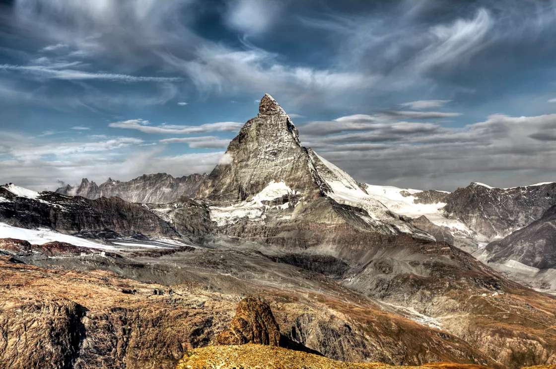
The famous Matterhorn in Switzerland displays three types of glacial erosion:
- Cirques are created when glaciers erode the mountainside, scouring into it and creating rounded hollows with steep uphill faces, shaped like tilted bowls. A cirque is often more visible after the glacier melts away and leaves the bowl-shaped landform behind.
- Arêtes are jagged, narrow ridges created where the back walls of two glaciers meet, eroding the ridge on both sides.
- Horns are created when several cirque glaciers erode a mountain until all that is left is a steep, pointed peak with sharp, ridge-like arêtes leading up to the top.
Glacial landforms
Fjords, glaciated valleys, and horns are all erosional types of landforms, created when a glacier cuts away at the landscape. Other types of glacial landforms are created by the features and sediments left behind after a glacier retreats.
When glaciers retreat, they often deposit large mounds of gravel, small rocks, sand, and mud, called till. It is made from the rock and soil that was ground up beneath the glacier as it moved.
Streams flowing from glaciers often carry some of the rock and soil debris out with them. These streams deposit the debris as they flow. Consequently, after many years, small steep-sided mounds of soil and gravel begin to form adjacent to the glacier, called kames. Eskers are meandering ridges of gravel that were likely deposited by rivers flowing on top of glaciers, through glacial cracks, and/or in tunnels under glaciers. Because glacier ice comprised the banks of these rivers, and that ice eventually melted away, the gravel deposited by the old rivers is now elevated above the surrounding land surfaces.
Kettle lakes form when a piece of glacier ice breaks off and becomes buried by glacial till or moraine deposits. Over time, the ice melts, leaving a small depression in the land, filled with water. Kettle lakes are usually very small, more like ponds than lakes.
Photo gallery of landforms
Glacial grooves and striations
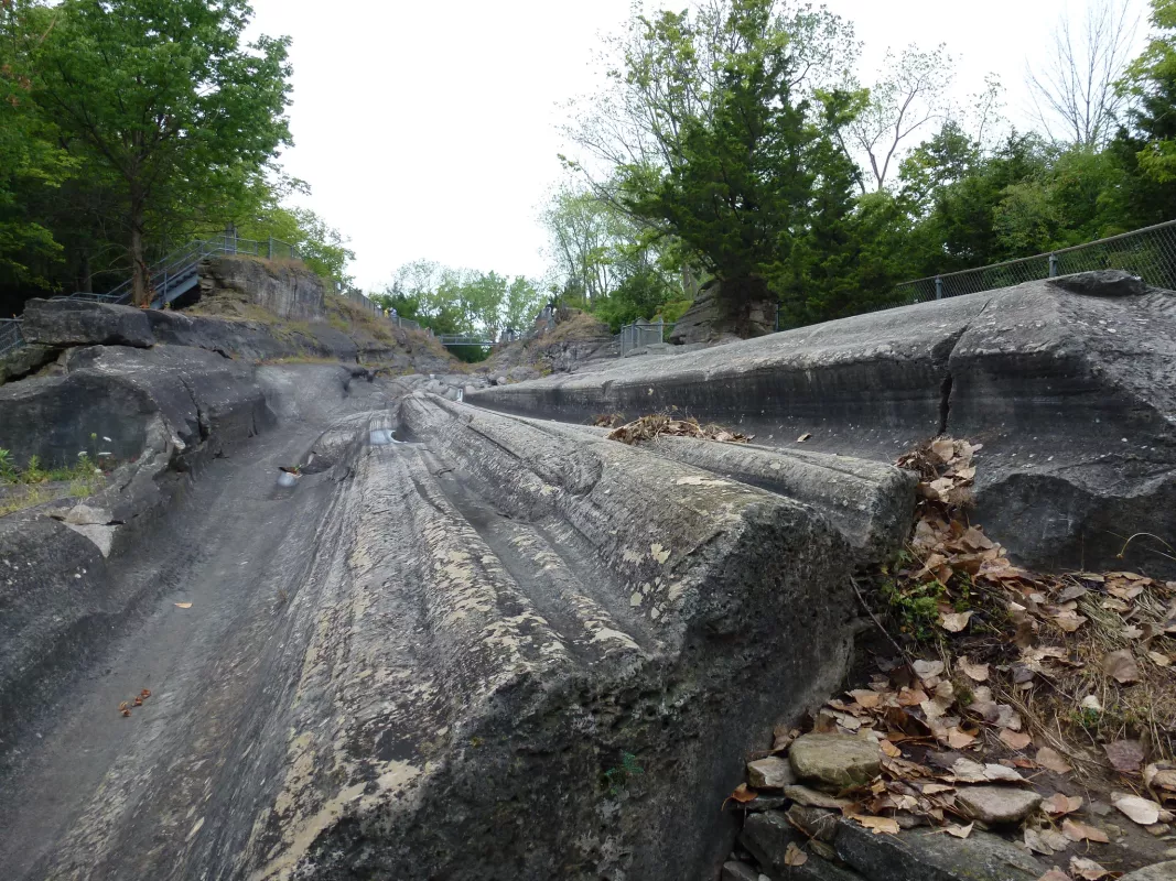
Glacial grooves and striations are gouged or scratched into bedrock as the glacier moves downstream. Boulders and coarse gravel get trapped under the glacial ice, and abrade the land as the glacier pushes and pulls them along.
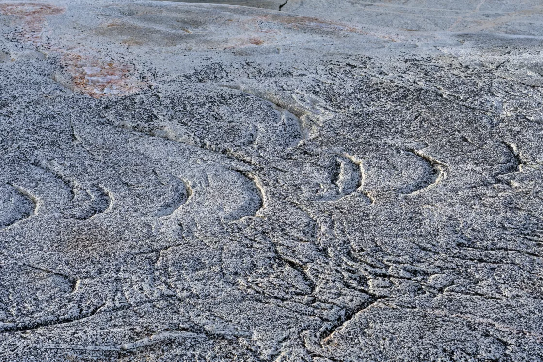
Chatter marks are a series of often crescent-shaped gauges chipped out of the bedrock as a glacier drags rock fragments underneath it.
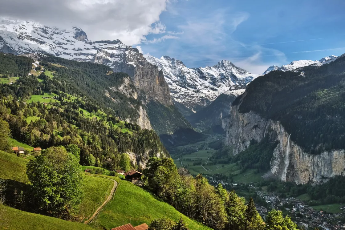
Glacial troughs, or glaciated valleys, are long, U-shaped valleys that were carved out by glaciers that have since receded or disappeared. Troughs tend to have flat valley floors and steep, straight sides.
Fjords
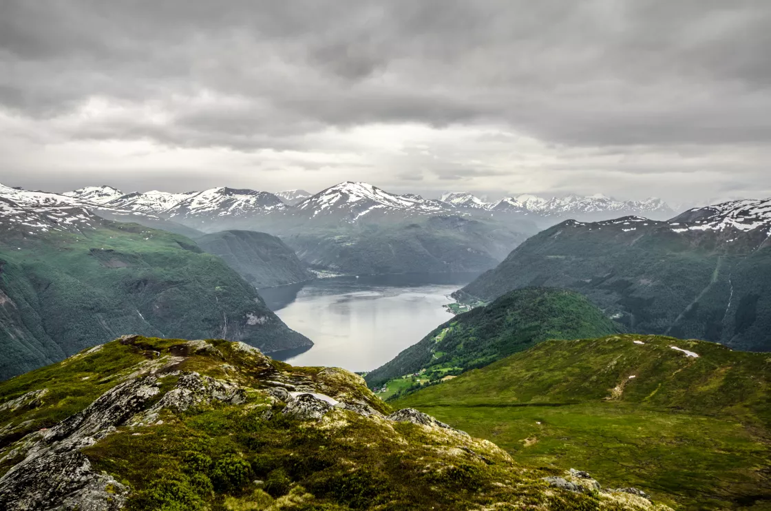
Fjords, such as those in Norway, are coastal troughs carved out by glaciers. Once the glaciers receded, seawater covered the floor of the trough-shaped valleys to create fjords.
Moraines
Moraines are accumulations of dirt and rocks that have fallen onto the glacier surface or have been pushed along by the glacier as it moves. The dirt and rocks composing moraines can range in size from powdery silt to large rocks and boulders. A receding glacier can leave behind moraines that are visible long after the glacier retreats. As a glacier retreats, the ice literally melts away from underneath the moraines, so they leave long, narrow ridges that show where the glacier used to be. Glaciers do not always leave moraines behind, however, because sometimes the glacier’s own meltwater washes the material away.
Medial moraines run down the middle of a glacier, lateral moraines along the sides, and terminal moraines are found at the terminus, or snout, of a glacier. Sometimes one glacier flows into another, creating combined wider moraines. Often these linear deposits of rocks are left behind, almost intact, after the ice in a glacier has melted away. Studying these rocky debris remnants, and the sediments that were once beneath the glacier, is the subject of glacial geology and geomorphology.
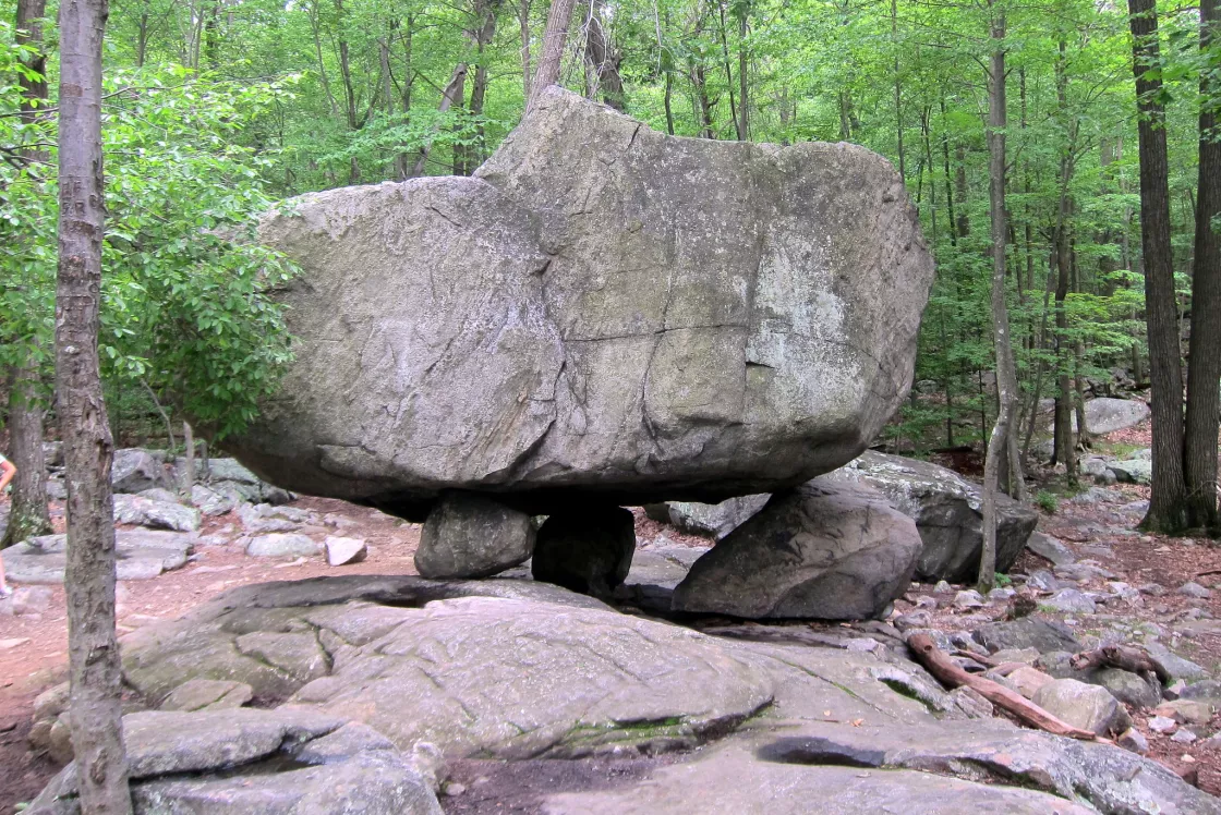
Glaciers leave behind anything they pick up along the way, and sometimes this includes huge rocks. Called glacial erratics or erratic boulders, these rocks might seem a little out of place, which is true because glaciers have literally moved them far away from their source before melting out from underneath them. Erratics can be carried for hundreds of kilometers and can range in size from pebbles to large boulders. Scientists sometimes use erratics to help determine ancient glacier movement.
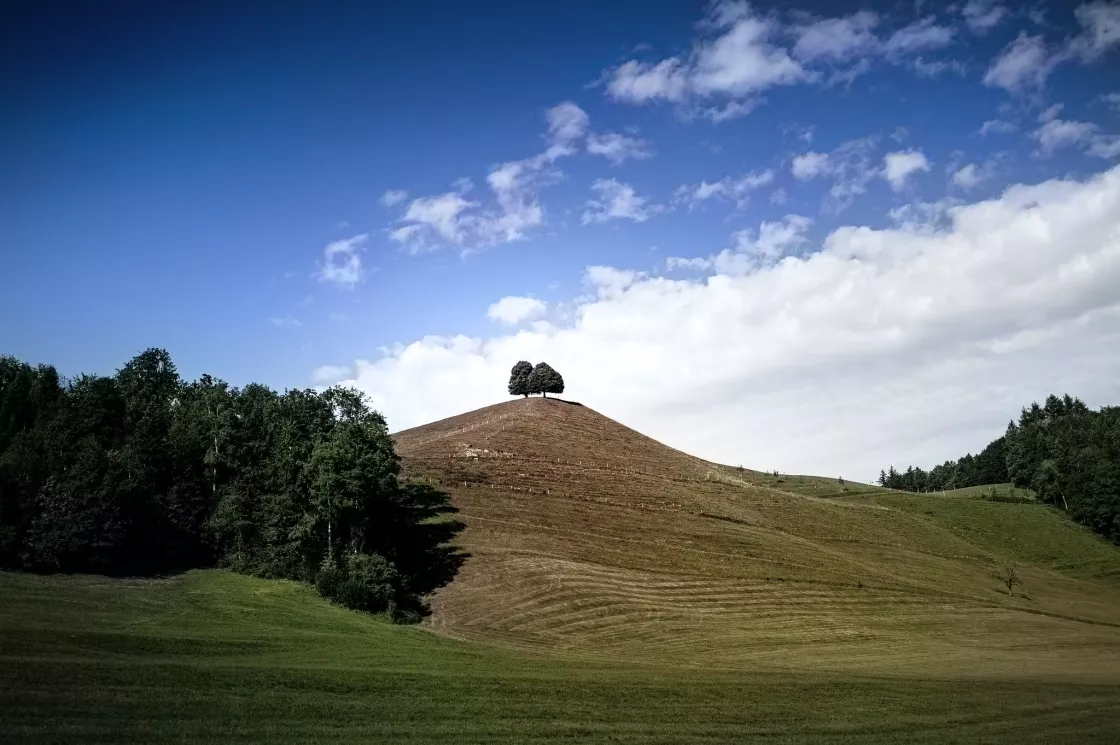
Drumlins are elongated, teardrop-shaped hills of rock, sand, and gravel that formed under moving glacier ice. What caused drumlins to form is poorly understood, but scientists believe that they were created subglacially as the ice sheets moved across the landscape during the various ice ages. Theories suggest that drumlins might have been formed as glaciers scraped up sediment from the underlying ground surface, or from erosion or deposition of sediment by glacial meltwater, or some combination of these processes. Because the till, sand, and gravel that form drumlins are deposited and shaped by glacier movement, all drumlins created by a particular glacier face the same direction, running parallel to the glacier's flow. Often, hundreds to thousands of drumlins are found in one place, looking very much like whale backs when seen from above. They can be up to 2 kilometers (1.25 miles) long.
Impacts of climate change on glaciers
Glaciers are useful indicators of climate change. The relationship between temperature and glacial fluctuations was the basis for scientific activity beginning in the eighteenth and nineteenth centuries and led directly to the formation of the International Commission of Snow and Ice in 1894. The study of glacier fluctuations is relevant to an understanding of climate and climate change over temporal scales from decades to thousands of years, and at regional to global spatial scales.
One of the most prominent signs of ongoing climatic change is that, with few exceptions, the vast majority of glaciers are shrinking worldwide. The 1991 discovery of the 5,000-year-old iceman preserved in a glacier in the European Alps fascinated the world, yet the discovery meant that this glacier was the thinnest it had been in the last 5,000 years. Glaciers around the world have retreated at unusually high rates over the last century. Some have disappeared altogether. Many more are retreating so rapidly that they may vanish within decades.
Since the Industrial Revolution, which began about 1760, human activity, such as burning fossil fuels, industrial processes, agriculture, and land-use change have increased the amount of carbon dioxide and methane (natural gas) in the atmosphere. In fact, these gases have reached higher concentrations in the atmosphere than at any time in the past 1,000,000 years. How do scientists know this? Because bubbles in glacial ice trap samples of Earth’s atmosphere, they record the composition of the atmosphere at the time ice is formed.
Heat-trapping gases, sometimes called greenhouse gases, are the cause of most of the climate warming and glacier retreat since the early twentieth century. Greenhouse gases include carbon dioxide (CO2) and methane (CH4). During the ice ages, CO2 levels were around 200 parts per million (ppm), and during the warmer interglacial periods, they hovered around 280 ppm. In 2013, CO2 levels surpassed 400 ppm for the first time in recorded history, and levels continue to rise. In March 2023, NOAA's Global Monitoring Laboratory reported a CO2 level of 421 ppm.
Greenhouse gases absorb heat being radiated from Earth’s surface, and by absorbing this heat the atmosphere and oceans slowly warm up. Warming ocean and air temperatures increase glacier ice melt. Thus, scientists have confirmed that glacial retreat is an unintended effect of the Industrial Revolution and modern energy use.
Increasing temperatures are not the only cause, however. Increased dust and soot from grazing, farming, and burning of fossil fuels and forests also increase glacier retreat. Dust and soot settle on glaciers to form a dark layer that absorbs more solar energy and increases their melt.
Glaciers move by internal deformation of ice (creep) and basal sliding under their own weight. The movement transfers ice, snow, and firn from locations with net accumulation to locations with net loss. For valley and mountain glaciers this movement is from the head of the glacier towards its terminus. If a glacier as a whole has a positive mass balance, the glacier terminus advances and the glacier expands in area. If a glacier has a negative mass balance, the amount of ice transferred to the terminus is not enough to offset ice melt and the position of the glacier terminus retreats and the glacier shrinks in area. Even though the terminus position is retreating, glacier ice is still moving towards the terminus. With a few exceptions, glaciers in all regions of the Earth have negative mass balances. Their termini are retreating and they are shrinking in area.
Glacier growth occurs when the amount of snow that accumulates on the glacier is greater than the amount of ice and snow that is lost from the glacier. Shrinkage occurs when the amount of snow and ice lost from is greater than the amount of snow that accumulates on a glacier. The difference between this accumulation and loss is called the mass balance. Growth occurs when the mass balance is positive. Shrinkage occurs when the mass balance is negative. Accumulation can occur by snowfall directly on the glacier surface but also from avalanches that deposit snow from slopes adjacent to the glacier and from snow being blown onto the glacier from surrounding areas. In some regions of the Earth, condensation of water vapor on glacier surfaces adds to accumulation. Ice and snow can be lost from the glacier by melting and runoff, evaporation of melt water, sublimation (the direct change from solid ice to water vapor), and through calving of ice is an increase in a glacier volume.
Photography captured glaciers as early as the mid-nineteenth century. Comparing aerial and ground photographs of glaciers bears witness to the dramatic change taking place. See NSIDC’s Repeat Photography of Glaciers in the Glacier Photography Collection. In the last few decades, satellite imagery has provided a means to monitor glacier extent changes worldwide, greatly expanding the areas of ice that scientists can examine. The Global Land Ice Measurements from Space (GLIMS) project, with participation from more than 60 institutions in 28 nations, has assembled a database of outlines and other data to quantify the past and present areal extent of existing glaciers.
Surface mass balance: a measure of glacial health
Mass balance is a measurement that determines a glacier’s health, whether it is stable, shrinking, or growing. A stable glacier has equal amounts of mass gain and loss over a year. In the spring and summer, a glacier loses mass to evaporation, melting, sublimation (when ice goes directly from solid to gas), or ice breaking off as icebergs. The difference between mass gains and losses for a given year describes the annual net mass balance, which corresponds to the change in glacier thickness and volume.
The critical link between glaciers and climate is the glacier mass balance. Mass balances of more than 300 glaciers have been measured at one time or another since 1946.Continuous mass balance records have been kept since the early 1960s. These results show that, in most regions of the world, glaciers are shrinking in mass. From 1961 to 2005, the thickness of “small” glaciers decreased approximately 12 meters (39 feet), or the equivalent of more than 9,000 cubic kilometers (2,160 cubic miles) of water.
A study published in 2014 showed that, starting in the late 1970s, glaciers “crossed an invisible line” into a declining state that cannot easily be attributed to natural causes. The study relied on multiple global climate models to simulate the mass balance of glaciers worldwide, excluding Antarctica. The authors concluded that, from 1851 to 2010, only about 25 percent of the glacier mass loss could be attributed to human-caused climate change. However, from 1991 to 2010, the glacier mass loss increased to about 69 percent, suggesting, with high confidence, a strong signal for human-caused climate change.
A study of observational data sets from the World Glacier Monitoring Service (WGMS) concluded that “rates of early twenty-first-century mass loss are without precedent on a global scale, at least for the time period observed and probably also for recorded history.” The Bulletin of the American Meteorological Society State of the Climate in 2015 reported that the cumulative mass balance loss between 1980 and 2015 is “the equivalent of cutting a 20.5-meter (67.3-feet) thick slice off the average glacier.”
The Glacier Model Intercomparison Project (GlacierMIP) is a climate project of the World Climate Research Project that focuses on the cryosphere. GlacierMIP issued an open call for data and received six published global glacier models in response. The models collectively produced 214 projections forced with 25 General Circulation Models (GCMs) and four different emission scenarios: Representative Concentration Pathways. The study projected mass changes for glaciers for the year 2100, relative to 2015. Global mass losses varied by model and emission scenario, though all models found significant mass loss.
Global sea level rise from melting glaciers
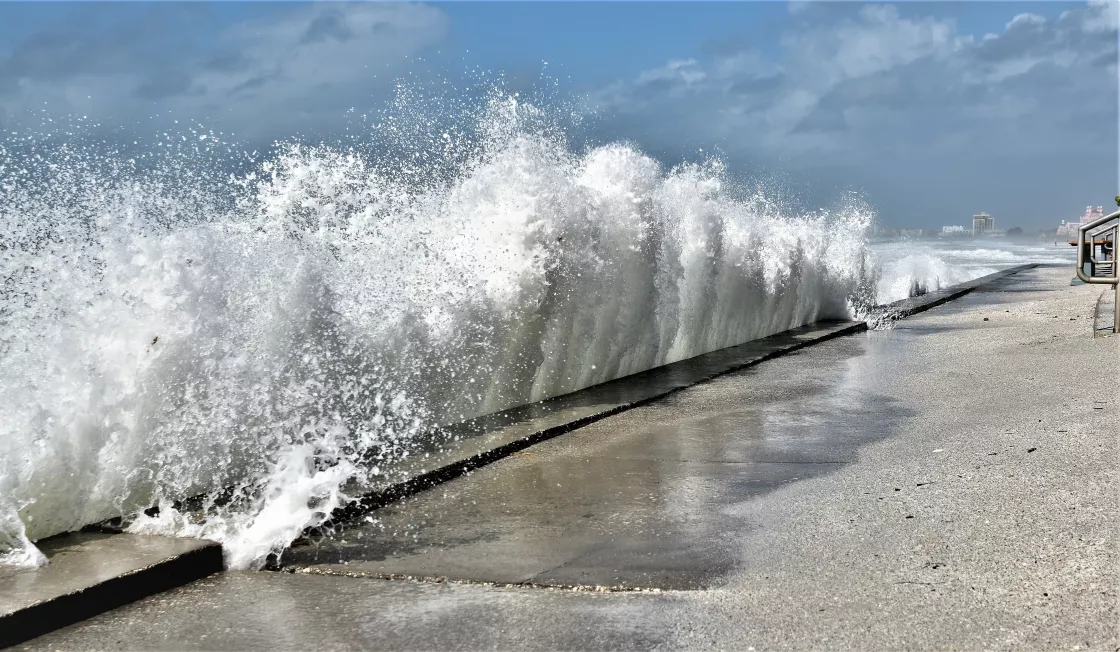
One of the most serious consequences of global warming is rising sea level. With so much human activity concentrated along coastlines and areas only a few meters above sea level, even modest flooding has already caused societal and economic distress. Based on the Intergovernmental Panel on Climate Change (IPCC), global sea level has risen since the early 1970s because of a combination of ocean thermal expansion and glacier mass loss, including mass loss from the Greenland Ice Sheet.
Global sea level is currently rising as a result of both ocean thermal expansion and glacier melt, with each accounting for about half of the observed sea level rise, and each caused by recent increases in global mean temperature. According to IPCC Climate Change 2021: The Physical Science Basis, global mean sea level increased by approximately 0.20 meters (0.66 feet) between 1901 and 2018. The average rate of sea level rise was approximately 1.3 millimeters (0.05 inches) per year between 1901 and 1971, increasing to approximately 1.9 millimeters (0.07 inches) between 1971 and 2006, and further increasing to approximately 3.7 millimeters (0.15 inches) between 2006 and 2018. The IPCC made this assessment with high confidence, and stated that human influence was very likely the main driver of rising sea level since at least 1971.
Antarctica and Greenland, the world's two ice sheets, make up the vast majority of the Earth's ice. If these ice sheets melted entirely, sea level would rise by more than 70 meters (230 feet). These ice sheets had long been believed to be in equilibrium, but more recent studies indicate growing ice sheet imbalance, with more mass leaving the ice sheet than is replaced by snowfall, especially in West Antarctica and Greenland.
In contrast to the polar regions, lower latitude small glaciers and ice caps, although making up only about four percent of the total land ice area or about 760,000 square kilometers (293,000 square miles), may have provided as much as 60 percent of the total glacier contribution to sea level change between the 1990s and 2010s.
An exception to the worldwide trend of glacier retreat occurs in the Karakoram region of the Western Himalaya. Known as the Karakoram anomaly, glaciers in this region have remained stable or even expanded over the past 150 years. The explanation for this unusual behavior may be meteorological. Other Himalayan glaciers receive most of their precipitation during the summer monsoon seasons and have experienced reduced snowfall. As is shown in the 2014 study, the Karakoram, has a unique seasonal cycle. The region receives most of its precipitation from non-monsoonal winter storms, staying mostly cool and dry during the summer. A subsequent study in 2019 likewise found that the western portion of South Asia is the one region in the world where glaciers are slightly gaining mass. Whether this unusual glacial stability and/or growth will continue in the coming decades remains unclear. But, according to a 2020 study that investigated the mechanisms behind the regional response, “long-term persistence seems unlikely in light of the considerable warming anticipated by current projections of future climate.”
The core of Earth’s climate history
Scientists extract ice cores from glaciers, ice sheets, and ice caps, studying them to learn about past changes in Earth's climate. Ice sheets are made up of layers of snow and ice that collected over millions of years. Those layers contain trapped gases, dust, and water molecules that scientists can use to study past climates.
Calving and ice loss
Calving is a process by which chunks of ice break off from ice shelves (the extensions of land ice that float on an ocean), glaciers, and icebergs. The huge, tabular icebergs are unique to Antarctica, and the process can take a decade or longer. Calving results from rifts that reach across the shelf. In the case of Antarctica's Amery Ice Shelf, the calving area resembles a loose tooth.
