News & Stories

Across the globe, snow and ice play a vital role in regulating Earth’s climate and providing freshwater resources to people, plants, and animals.

As Earth’s frozen regions change rapidly, NSIDC is committed to growing its research and open access data to better understand these changes. Read about NSIDC research and its contribution to science and policy making. Check out spotlights on how to use NSIDC data, tools, and resources. Learn about how we steward data and collaborate with scientists and organizations across the world to understand how the frozen parts of Earth affect the rest of the planet and impact society.
News and stories

Filter by:
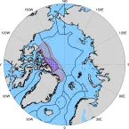
The map on the left shows the melt onset of Arctic Sea Ice for 2023. Different in 2023 melt onset date with the 1981 to 2010 melt date. Red indicates earlier than average melt onset; blue indicates later than average melt onset.
Analysis - Sea Ice Today

After declining at a near-average pace for much of the summer, Arctic sea ice loss accelerated during early August.

Overlooking a glacial river on Greenland Ice Sheet
Feature Story
In 2011, a group of scientists in southeastern Greenland discovered a massive perennial firn aquifer—a year-round, water-bearing layer within the firn. Since then, scientists have discovered more areas around the world bearing this ice feature, but questions remain to their development and impact.
Analysis - Sea Ice Today

While large parts of the world saw record breaking heat in July, and Antarctic sea ice extent remained at record daily lows as assessed over the satellite record, Arctic sea ice extent for July was only the twelfth lowest in the satellite record.

Melting ice and ice mélange near Qaanaaq, Greenland.
Analysis - Ice Sheets Today
Late June ushered in a significant shift in weather and melting for Greenland, particularly for the southern portion of the ice sheet, known as South Dome, where melting is currently on a record pace. Melting along the northern rim of the ice sheet is also greater than average.
This true color composite image from the NASA Moderate Resolution Imaging Spectroradiometer (MODIS) on July 16 shows the North Pole at the center of the image, with Greenland pointing down.
Analysis - Sea Ice Today

Arctic sea ice continues to decline at a near-average pace, with ice extent twelfth lowest in the satellite record at this time.

This image of a wooden engraving depicts the USS Jeannette as it leaves San Francisco in 1879, en route to the North Pole. Credit: US Naval History and Heritage Command Photograph
Feature Story
In July 1879, the USS Jeannette left port in San Francisco en route to the North Pole. What lay at the top of the world was still shrouded in mystery. Was it a warm inland sea, a sheet of ice, or open ocean? The crew set out to find out. The majority of the crew of the USS Jeannette perished during the journey, but their memory lives on through the invaluable scientific information that they laboriously collected and returned to civilization.