Our Research
As climate changes, how do Earth's frozen areas affect our planet and impact society?
In this section
Related News & Stories
Filter by:

Spotlight
The ICESat-2 mission provides data sets on land ice and sea ice, and those data sets have been applied to myriad studies of Earth’s frozen regions, but ICESat-2 data offerings do not end there. Researchers can also use ICESat-2 observations to study surface-height changes in land and vegetation, inland water bodies, ocean surfaces, and atmospheric features.

Analysis - Sea Ice Today
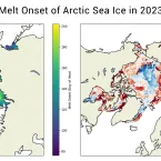
After declining at a near-average pace for much of the summer, Arctic sea ice loss accelerated during early August.

Feature Story
In 2011, a group of scientists in southeastern Greenland discovered a massive perennial firn aquifer—a year-round, water-bearing layer within the firn. Since then, scientists have discovered more areas around the world bearing this ice feature, but questions remain to their development and impact.

ELOKA Spotlight
In November 2022, videography experts from the organization See Stories taught videomaking skills to a classroom of Chevak sixth graders in Alaska. Fifteen short videos will eventually make it the online Nunaput Atlas, which NSIDC's Exchange for Local Observations and Knowledge of the Arctic (ELOKA) program helped create.
Analysis - Sea Ice Today
While large parts of the world saw record breaking heat in July, and Antarctic sea ice extent remained at record daily lows as assessed over the satellite record, Arctic sea ice extent for July was only the twelfth lowest in the satellite record.

Analysis - Ice Sheets Today
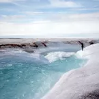
Late June ushered in a significant shift in weather and melting for Greenland, particularly for the southern portion of the ice sheet, known as South Dome, where melting is currently on a record pace. Melting along the northern rim of the ice sheet is also greater than average.