By Agnieszka Gautier
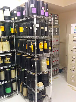
In 1996, NSIDC received ninety-nine canisters of ungainly film rolls. Each stored hundreds of photographs, most of sea ice, but also glaciers, land, snow cover, and coastlines dating as far back as 1962. The photographs, part of the U.S. Navy-initiated Project Birdseye, offered never before seen images of the Arctic at the height of the Cold War, when the area had potential to become a theater of operations. Today, this abandoned military research operation might extend valuable knowledge to scientists studying changes in the Arctic.
“We don’t have a lot of Arctic Ocean data that starts in the 1960s,” said Ann Windnagel, project manager at NSIDC, “because the satellite record doesn’t start for another decade.” The long and uncertain journey of these ninety-nine canisters epitomizes the difficulty of reviving old data. With technology progressing at an increasing pace, information is in danger of getting left behind. “Birdseye is a data rescue story,” said Florence Fetterer, who oversees NOAA programs and projects at NSIDC. “It’s important to preserve material like this because it’s a record of an ice cover that’s quickly disappearing.” NSIDC became a steward of this data almost twenty years ago; can NSIDC not only restore the project’s data, but actually make it accessible to the public?
From project to journey
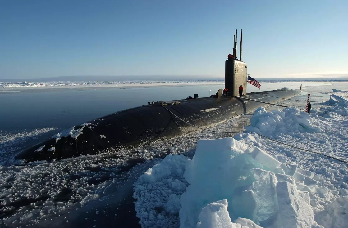
Project Birdseye aimed to understand the Arctic Ocean, and in particular, sea ice. “The Navy was way out ahead of the game in terms of researching the Arctic Ocean,” Fetterer said. Unlike surface ships, submarines had the then-unique ability to operate and take measurements regardless of sea ice cover, weather conditions, and time of year. Much of the ocean basin could be comprehensively investigated. With Soviet nuclear submarines capable of targeting US coastlines, the Navy needed to know how to operate in the Arctic. It meant knowing how to predict ice behavior, and where the ice might be thin enough for a submarine to surface. Project Birdseye lasted from 1962 to the mid 1980s, generating important weather reports, aerial photographs, and other data. However, the photographs remained as the sole comprehensive data of the project. Much from the naval research operation has been destroyed or lost. “Other aircraft instrument data never made it out,” Windnagel said. The Cold Regions Research and Engineering Laboratory (CRREL) in Hanover, New Hampshire stored the surviving ninety-nine canisters until 1996 when NSIDC petitioned for their stewardship. “It was an act of faith to take them,” Fetterer said. “These canisters are huge.” They measure at a foot tall and six inches in diameter. Storing them was just one of the challenges. “Would we ever publish them; what’s the point?” Fetterer asked. The ninety-nine canisters sat on shelves in an interior room at NSIDC for years, then were moved to an adjacent building, only to come back once NSIDC and its NOAA data center partner received grant money to scan the images. And so, ten years after they arrived, off the ninety-nine canisters went back east to a lab with the proper machines to handle the material. Only seven of the ninety-nine got scanned. Funding died. The canisters traveled back onto NSIDC shelves to await future opportunities. In the meantime, with images digitized, another issue developed. No documentation accompanied the photographs. How would the data be organized? What could the data offer? “Getting it online and getting it fully documented, meant the project got pushed back,” Fetterer said. “Other things took priority.”
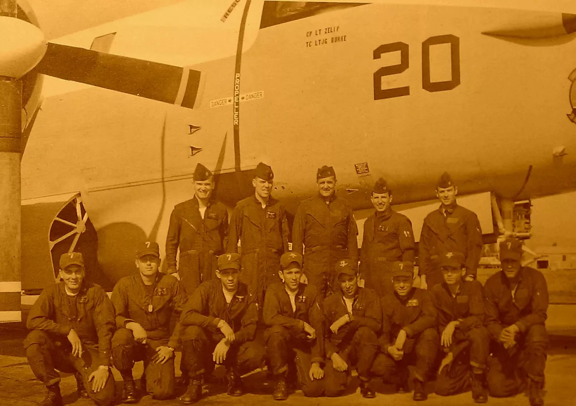
That is until Brian Zelip, a graduate student at the Graduate School of Library and Information Science at Illinois University, took interest. He managed to find a lot of material that NSIDC simply did not have. Working with the Matthew Fontaine Maury Oceanographic Library in Mississippi, Zelip found seventy-two reports describing the missions, historical photos of the crew and airplanes to give a human component to Project Birdseye. “Putting the pieces together, the history, that’s exciting,” Windnagel said. “Seeing that some of the reports matched up to the photographs we had was a big ‘Aha’ moment.” Now the images could be given context.
What now?
With summer sea ice receding, the Arctic yet again is an area of interest. Bordering the United States, Canada, Nordic countries, and Russia, the Arctic’s potential for international dispute continues. New shipping lanes and fishing waters have already been tested. Further into the Arctic Ocean national boundaries blur. Containing a significant portion of the world’s undiscovered oil and untapped gas, who owns what may become an increasingly sensitive issue. Having knowledge of how the Arctic functions may be key to successful diplomacy, but could Project Birdseye offer any scientific value to the photographs? And really, do we even know that yet?
Project Birdseye captures one of the earliest large-scale photographic records of sea ice, but someone has to unravel the meaning behind the images. “We put a lot of the pieces of the data out there,” Windnagel said. “But we didn’t analyze it.” That is for someone else to do. “It’s not like a computer that can just digest numbers. Someone has to look at these photographs,” Windnagel added. “The pictures are great, though limited because they’re just flight lines.” A flight line illustrates the path of an airplane with photography below, unlike a satellite that offers a more complete record from multiple orbits. Nine flights a year for roughly twenty years provides some clues across the Arctic. “Since the flight tracks and altitude varied by mission, the images offer more of a spatial and temporal snapshot, a slice of the Arctic,” Windnagel said.
“Though we didn’t get everything online, there now is a substantial record so that those that come after us, will at least know what it was and where to pick up the pieces,” Fetterer said. Now, almost twenty years later, 1,752 images from seven of the ninety-nine canisters are available online at NSIDC. Meanwhile, ninety-two canisters hold thousands of photographs of the Arctic yet to be seen.


