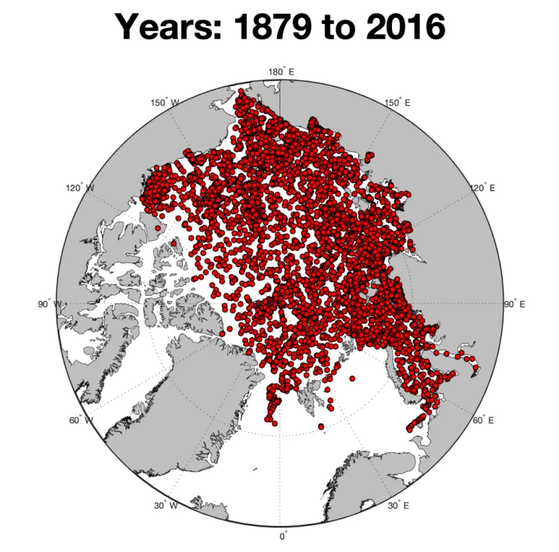
NOAA@NSIDC is pleased to announce the release of version 2 of On-Ice Arctic Sea Ice Thickness Measurements by Auger, Core, and Electromagnetic Induction, from the Late 1800s Onward. In addition to sea ice thickness, the data set provides sea ice freeboard and snow depth on sea ice from on-ice measurements taken primarily using auger, coring devices, and electromagnetic (EM) sounding. When available, ice type is also included. Version 2 of the archive was compiled from 50 different expeditions starting with measurements from the Jeannette Expedition from 1879 to 1881, then to the Fram Expedition in 1894 and 1895, the Maud Expedition from 1922 through 1924, and continues to the most recent record to date from 2016. The data set consists of 69,482 ice-thickness measurements from across the Arctic. The figure below shows a map with the location and density of the measurements. These data were compiled by Benjamin Holt, an investigator at the Jet Propulsion Laboratory, Pasadena, California. He saw a need to collect many scattered smaller collections into a larger archive that would receive metadata and documentation so that the data could be more easily found and used. In addition to planned augmentation to the collection by the investigator, other investigators are encouraged to either add data themselves or to provide suggestions by contacting NSIDC. To learn more and to access the On-Ice Arctic Sea Ice Thickness Version 2 data, see the data set landing page. Data Set DOI: https://doi.org/10.7265/wz0k-4p60
Data Announcement
Version 2 of On-Ice Arctic Sea Ice Thickness Measurements from 1879 to 2016 Now Available
FRIDAY, NOVEMBER 8, 2019
