Greenland Ice sheet Mapping Project (GrIMP)
Greenland Ice sheet Mapping Project (GrIMP)
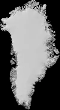
The Greenland Ice sheet Mapping Project (GrIMP) creates and provides benchmark data sets for observing Greenland ice sheet change and stability. The temporal range of data ranges from the year 1985 to present. GrIMP data products include ice sheet-wide ice velocity, surface elevation, and surface morphology maps.
The data products are compiled from multiple satellites and sensors including U.S. Geological Survey's (USGS) and NASA's Landsat 7 and Landsat 8; European Space Agency's (ESA) Copernicus Sentinel-1; German Aerospace Center's (DLR) TerraSAR-X/TandDEM-X; Canadian Space Agency's (CSA) RADARSAT-1 and RADARSAT-2. GrIMP is a NASA Making Earth System Data Records for Use in Research Environments (MEaSUREs) project. MEaSUREs projects enable Earth science researchers to develop satellite-derived, value-added data products.
Greenland-wide Velocity Mosaics from 2015 onwards
Summary Description: This product series is largely based on the Copernicus Sentinel 1 (EU/ESA) mission, which began providing large volumes of data in 2015. For all but the 6/12 day products, the mosaics also include data from the Landsat (USGS), TerraSAR-X/TanDEM-X (DLR), and COSMO-SkyMed (ASI) missions.
Annual: MEaSUREs Greenland Annual Ice Sheet Velocity Mosaics from SAR and Landsat (NSIDC-0725)
Quarterly: MEaSUREs Greenland Quarterly Ice Sheet Velocity Mosaics from SAR and Landsat (NSIDC-0727)
Monthly: (MEaSUREs Greenland Monthly Ice Sheet Velocity Mosaics from SAR and Landsat (NSIDC-0731)
6/12 day sampling: 6/12-day sampling MEaSUREs Greenland 6 and 12 day Ice Sheet Velocity Mosaics from SAR (NSIDC-0766)
Other Greenland-wide Velocity Mosaics
Summary Description: This product series includes full Greenland velocity mosaics largely generated from pre-2015 data, including RADARSAT (CSA), ALOS 1 (JAXA), TerraSAR-X/TanDEM-X (DLR), Landsat (USGS), and ERS-1/2 (ESA). Data acquisitions were less frequent in this time period so the NSIDC-0478 mosaic series only samples velocity for several winters starting in 2000. The NSIDC-0670 mosaic averages all available data from 1995 to 2015 to provide a multi-decade average velocity map.
Winters starting in 2000: MEaSUREs Greenland Ice Sheet Velocity Map from InSAR Data (NSIDC-0478)
Multi-decadal average map: MEaSUREs Multi-year Greenland Ice Sheet Velocity Mosaic (NSIDC-670)
Select Glacier Velocity Maps
Summary Description: This product series includes maps for a select set of glaciers around the Greenland Margin. The NSIDC-0481 products are derived from TerraSAR-X/TanDEM-X (DLR) data, using acquisitions that begin in 2008. The NISDC-0646 (monthly) and NSIDC-0777 (pair data) are derived from data collected by the Landsat missions (USGS) and extend back to 1985. For both data sets, each glacier is assigned to a common box with a name based on its East/West/North and latitude position (e.g., E68.80N and W69.10N).
TerraSAR-X/TanDEM-X (DLR): MEaSUREs Greenland Ice Velocity: Selected Glacier Site Velocity Maps from InSAR (NSIDC-0481)
Monthly (Landsat): MEaSURES Greenland Ice Velocity: Selected Glacier Site Velocity Maps from Optical Images (NSIDC-0646)
Single-pair (Landsat): MEaSUREs Greenland Ice Velocity: Selected Glacier Site Single-Pair Velocity Maps from Optical Images, Version 1 (NSIDC-0777
Greenland Digital Elevation Mosaics
Summary Description: This product series includes full Greenland Digital Elevation Models (DEMs) derived from stereo photogrammetry and posted at 30 m. The earlier DEM (NSIDIC-0645) was constructed by combining ASTER and SPOT 5 DEMs over the ice sheet periphery and margin with AVHRR photoclinometry for the interior and far north from 2003 to 2009. The later DEM (NSIDC-0715) was derived from sub-meter resolution, panchromatic stereoscopic imagery collected by the GeoEye-1, WorldView-1, -2, and -3 satellites operated by Maxar Technologies.
Earlier DEM: MEaSURES Greenland Ice Mapping Project (GIMP) Digital Elevation Model (NSIDC-0645)
Greenland Image Mosaics
Summary Description: This family of products consists of optical and SAR image mosaics of Greenland. The earlier SAR mosaics (NSIDC-0633) are derived from RADARSAT (CSA) and (ALOS) data and the later (NSIDC-0731) SAR mosaics are from Copernicus Sentinel 1A/B data (ESA/EU). The optical mosaics are constructed from Landsat (NSIDC-0713) and MODIS (NSDIC-0724) data.
Earlier/SAR: MEaSUREs Greenland Ice Sheet Mosaics from SAR Data (NSIDC-0633)
Later/SAR: MEaSUREs Greenland Image Mosaics from Sentinel-1A and -1B (NSIDC-0723)
Optical/Landsat: MEaSUREs Greenland Ice Mapping Project (GIMP) 2000 Image Mosaic (NSIDC-0713)
Optical/MODIS: MEaSUREs Greenland Monthly Image Mosaics from MODIS (NSIDC-0724)
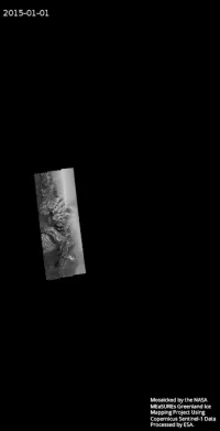
Note: Click the image on the left to animate it. You can also download a high-resolution version of the animated image on the left (EarthData login required for access).
Other Greenland Geospatial Data
Summary Description: This group includes annual terminus positions (NSIDC-0642) digitized from optical and SAR data. Also included is a land classification (ocean/ice/rock) map (NSIDC-0714).
Terminus positions: MEaSUREs Annual Greenland Outlet Glacier Terminus Positions from SAR Mosaics (NSIDC-0642)
Classification map: MEaSUREs Greenland Ice Mapping Project (GIMP) Land Ice and Ocean Classification Mask (NSIDC-0714)
GrIMP Data Tools
The GrIMP project has developed several tools for accessing and working with the data remotely, eliminating the need for voluminous downloads in many studies.
The tools are all built from open source Python code that is called from Jupyter notebooks. The examples have been structured with default parameters to do much of what the typical user may wish to do, with little or no python knowledge.
Videos
Team
The GrIMP project principal investigators are Ian Joughin of the Applied Physics Laboratory and Ian Howat of the Byrd Polar Research Center.
Funding
The Greenland Ice sheet Mapping Project (GrIMP) is a NASA Making Earth System Data Records for Use in Research Environments (MEaSUREs) project. MEaSUREs projects enable Earth science researchers to develop satellite-derived, value-added data products.


