Cryosphere glossary
the difference between a measured value of a quantity and its true value; different types of errors are inherent to observations.
a sinuous ridge of sedimentary material (typically gravel or sand) deposited by streams that cut channels under or through the glacier ice.
the physical process by which a liquid or solid substance is transformed to the gaseous state; the opposite of condensation; in meteorology, evaporation usually is restricted in use to the change of water from liquid to gas, while sublimation is used to the change from solid to gas as well as from gas to solid.
the volume of ice in the ground which exceeds the total pore volume that the ground would have under natural unfrozen conditions.
(1) (North American usage) permafrost underlying 65 - 90% of the area of exposed land surface (2) (Russian usage) permafrost underlying 70 - 80% of the area of exposed land surface.
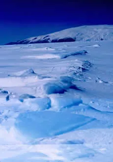
Ice that is anchored to the shore or ocean bottom, typically over shallow ocean shelves at continental margins; fast ice is defined by the fact that it does not move with the winds or currents. Also known as landfast ice.
Image

Note: This is land fast ice.
Michael Van Woert, National Oceanic and Atmospheric Administration/Department of Commerce
a region of space at each point of which a given physical or mathematical quantity has some definite value; for example, a gravitational field, magnetic field, or electric field; and, in meteorology, a pressure field, temperature field, etc; if the quantity specified at each point is a vector quantity, the field is said to be a vector field.
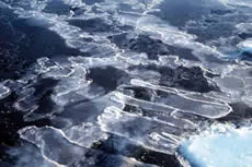
a process by which currents or winds push around thin ice so they slide over each other.
Image

Nilas showing finger rafting.
Antarctic Sea-Ice Processes and Climate (ASPeCt)
rounded, well-bonded snow that is older than one year; firn has a density greater than 550 kilograms per cubic-meter (35 pounds per cubic-foot); called névé during the first year.
the minimum elevation of firn lying on a glacier surface; each year's firn line marks a glacier's annual equilibrium line; also called firn line.
the minimum elevation of firn lying on a glacier surface; each year's firn line marks a glacier's annual equilibrium line; also called firn limit.
the height of meltwater within saturated firn that is trapped over ice in a glacier.
a thin sheet of ice formed on the glacier surface by rapid refreezing of solar-heated snow or firn, usually at high elevations during spring.
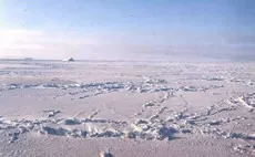
floating ice of no more than one year's growth developing from young ice; thickness from 0.3 to 2 meters (1 to 6.6 feet); characteristically level where undisturbed by pressure, but where ridges occur, they are rough and sharply angular.
Image

Ted Maksym, United States Naval Academy