News & Stories

Across the globe, snow and ice play a vital role in regulating Earth’s climate and providing freshwater resources to people, plants, and animals.

As Earth’s frozen regions change rapidly, NSIDC is committed to growing its research and open access data to better understand these changes. Read about NSIDC research and its contribution to science and policy making. Check out spotlights on how to use NSIDC data, tools, and resources. Learn about how we steward data and collaborate with scientists and organizations across the world to understand how the frozen parts of Earth affect the rest of the planet and impact society.
News and stories

Filter by:
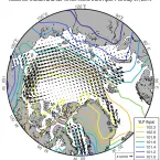
Map of the Arctic shows average fields of ice drift and sea level pressure (SLP) from April 1 to May 31, 2019.
Analysis - Sea Ice Today

While Arctic sea ice extent was tracking at record low levels in July and August, the pace of ice loss slowed considerably after the middle of August, despite above-average air temperatures over much of the Arctic Ocean.

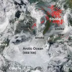
NASA Worldview image from August 10, 2019, shows the locations of wildfires in the Arctic as detected by thermal images (not shown).
Analysis - Sea Ice Today

At mid-month, Arctic sea ice extent is tracking close to 2012, the year with the lowest minimum in the satellite record. Sea ice volume is also tracking at low levels.

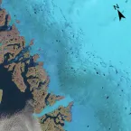
Figure 5b: Satellite image
Analysis - Ice Sheets Today
Warm air from Europe's heat wave reached Greenland on July 29 and 30, setting temperature records at Summit Station and melting about 90 percent of the ice sheet surface from July 30 to August 3. Melt runoff was estimated at 55 billion tons during the interval.
Analysis - Sea Ice Today

Loss of ice extent through the first half of July matched loss rates observed in 2012, the year which had the lowest September sea ice extent in the satellite record.