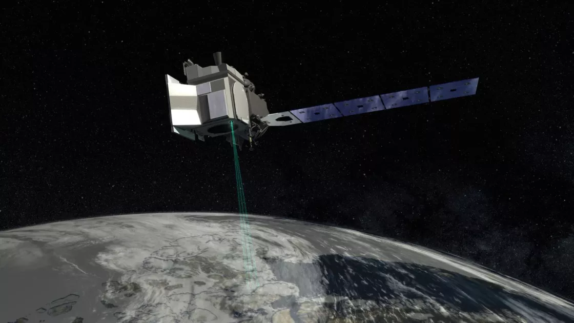
In September 2018, NASA launched the Ice, Cloud and land Elevation Satellite-2 (ICESat-2) to help scientists investigate why and how much the frozen parts of our world are changing as a result of global warming. This week, nearly two years after data initially became available to the public, downloads of data files from the satellite hit 10 million. All ICESat-2 data are housed and managed at the NASA National Snow and Ice Data Center Distributed Active Archive Center (NSIDC DAAC).
“This milestone represents the wide acceptance and use of ICESat-2 data by the research community, with nearly 3,000 scientists accessing the data thus far,” said Steve Tanner, the ICESat-2 data manager for the NSIDC DAAC. “With its global coverage and the wide range of data products, the science community is able to use ICESat-2 to study sea ice, land ice, vegetation and even bathymetry (water depth) with a resolution never available before on this scale.”
As ICESat-2 orbits Earth, it carries an instrument called a laser altimeter to map a planet’s terrain, allowing scientists to measure the elevation of ice sheets, glaciers, sea ice and more in unprecedented detail. This laser altimeter, known as the Advanced Topographic Laser Altimeter System (ATLAS), is a fast-firing instrument; it sends 10,000 laser pulses per second containing trillions of photons, as compared with only 40 pulses per second from its predecessor, and takes measurements every 28 inches along the satellite's path. It uses six separate laser beams as opposed to its predecessor’s single beam. ATLAS collects an exceptional amount of data—so much that scientists can use it to estimate the annual height change of the Greenland and Antarctic ice sheets to within four millimeters (about one-sixth of an inch).
Scientists also use the information gathered by ATLAS to monitor how much mass glaciers are gaining or losing in different regions, to estimate the thickness of sea ice and to monitor changes to these areas. However, these data are valuable beyond studying changes in Arctic and Antarctic ice. For example, researchers are also using them to study coastal ecosystems, as ICESat-2 can penetrate water and measure the sea bed in shallows along coastlines around the world. Others are using the data to study forests, since the satellite measures canopy heights in rainforests, boreal forests and more. ICESat-2 even measures the height of individual waves as it passes over open oceans.
“ICESat-2 represents a big leap forward in our ability to understand the changes in polar ice, land and vegetation,” said Walt Meier, lead scientist for the NSIDC DAAC. “Scientists are constantly finding new uses for the sensor that were not originally planned for, and the great thing is that ICESat-2 is just getting started. We are about two years into a planned three-year mission, and we are hopeful it may last much longer than that. That means there is the potential for a long record of important climate data.”
The NSIDC DAAC ingests, archives and manages all ICESat-2 data. Data are freely available to anyone who wishes to use them. Multiple data sets are available, from raw photon measurements up to highly processed data aimed at specific topics like sea ice freeboard or the surfaces of inland lakes. New products are expected to become available in the future as well, as the ICESat-2 science team learns more about using the data and what can be derived from it.
The ICESat-2 mission follows and advances the Ice, Cloud and land Elevation Satellite (ICESat) mission, which operated from 2003 to 2009, and Operation IceBridge, an airborne mission that operated from 2009 to 2019 to bridge the gap between ICESat and ICESat-2.
To learn more and download ICESat-2 data, visit the NSIDC DAAC.
