Ask a Scientist

These articles provide answers to frequently asked questions related to Earth's frozen realms. Questions range from general background information and detailed science processes to the data gathered and archived at the National Snow and Ice Data Center (NSIDC) and its data management programs including NOAA@NSIDC, the NASA NSIDC Distributed Active Archive Center (DAAC), and the Exchange for Local Observations and Knowledge of the Arctic (ELOKA). If you have a question that is not answered here, please contact NSIDC User Services.
 

Filter by:
AIDJEX1972_001_1
A tipping point is a critical threshold where an incremental change could push a system over the edge to a new state. Two types of tipping points exist. One involves a rapid transition, like what happens when a canoe rocks back and forth. Eventually
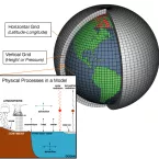
AtmosphericModelSchematic_1
Climate models, also known as general circulation models or GCMs, use computers to simulate Earth’s climate. Scientists use climate models to predict weather, but unlike weather forecasts, the timespan is over decades or centuries rather than hours
Arctic storm
Over the course of the satellite record, Arctic sea ice extent has declined. Declines have been observed throughout the year, but they have been most pronounced at the time of the annual minimum each September. Lower sea ice minimums raise a question
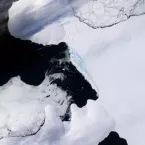
Ice melange after Wilkins breakup, 2008
The Wilkins Ice Shelf is one of many thick slabs of ice that cling to Antarctica’s coast. Most of the continent’s ice sheet ends in one of these ice extensions that floats on the surrounding ocean water. Like the Larsen Ice Shelf, the Wilkins Ice