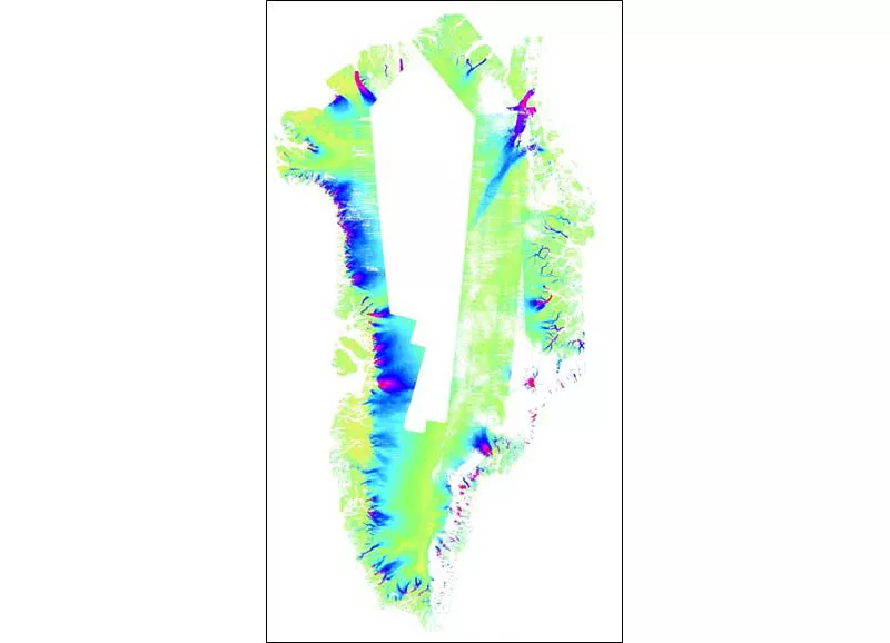
MEaSUREs Greenland 6 and 12 day Ice Sheet Velocity Mosaics from SAR, Version 1
Data set id:
NSIDC-0766
DOI: 10.5067/6JKYGMOZQFYJ
There is a more recent version of these data.
Version Summary
Version Summary
Initial release
Overview
This data set contains 6 and 12 day surface velocity estimates for the Greenland Ice Sheet and periphery derived from images acquired between 2015–2021 by the European Space Agency (ESA) Copernicus Sentinel-1A and Sentinel-1B satellites.
Parameter(s):
ICE VELOCITY
Platform(s):
Sentinel-1A, Sentinel-1B
Sensor(s):
C-SAR
Data Format(s):
GeoTIFF, JPEG, Shapefile
Temporal Coverage:
1 January 2015 to 3 February 2021
Temporal Resolution:
- 6 days to 12 days
Spatial Resolution:
- 200 m
- 200 m
Spatial Reference System(s):
WGS 84 / NSIDC Sea Ice Polar Stereographic North
EPSG:3413
Spatial Coverage:
N:
83
S:
60
E:
-14
W:
-75
Blue outlined yellow areas on the map below indicate the spatial coverage for this data set.
Data Access & Tools
A free NASA Earthdata Login account is required to access these data. Learn More
Sample Data Image
Image

This color-coded map shows a six-day ice velocity mosaic for the Greenland Ice Sheet. Highest velocities appear in magenta and red, intermediate velocities appear in blue and green, and lowest velocities appear in yellow and peach. White patches indicate no data. Credit: NASA MEaSUREs GrIMP Data: ESA